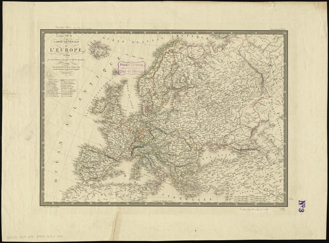
Carte générale de l'Europe, en 1824
Item Information
- Title:
- Carte générale de l'Europe, en 1824
- Creator:
- Brué, Adrien Hubert, 1786-1832
- Name on Item:
-
par A.H. Brué, géographe de S.A.R., monsieur.
- Date:
-
1824
- Format:
-
Maps/Atlases
- Location:
-
Boston Public Library
Norman B. Leventhal Map Center - Collection (local):
-
Norman B. Leventhal Map Center Collection
- Subjects:
-
Europe--Maps
- Places:
-
Europe
Europe
- Extent:
- 1 map : hand colored ; 45 x 50 cm
- Terms of Use:
-
No known copyright restrictions.
No known restrictions on use.
- Publisher:
-
Paris :
chez l'auteur,
- Scale:
-
Scale approximately 1:12,500,000
- Language:
-
French
- Notes:
-
Relief shown by hachures.
Prime meridian: Paris.
In upper right: Atlas universel pl. 12.
Includes references to German states.
- Identifier:
-
06_01_012018
- Call #:
-
G5700 1824 .B78
- Barcode:
-
39999065691030


