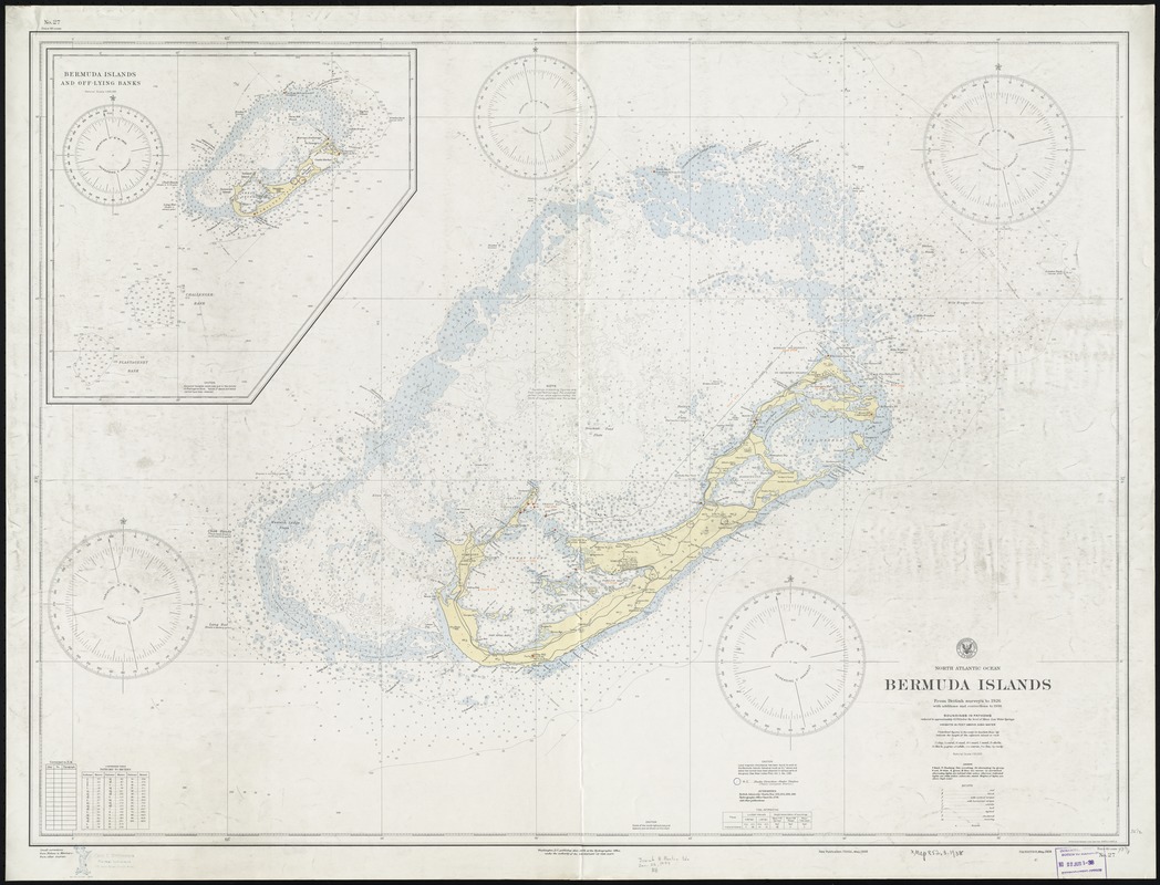
North Atlantic Ocean, Bermuda Islands : from British surveys to 1926, with additions and corrections to 1936
Item Information
- Title:
- North Atlantic Ocean, Bermuda Islands : from British surveys to 1926, with additions and corrections to 1936
- Title (alt.):
-
Bermuda Islands
- Title (uniform):
-
Charts, etc
- Creator:
- United States. Hydrographic Office
- Date:
-
1938
- Format:
-
Maps/Atlases
- Location:
-
Boston Public Library
Norman B. Leventhal Map Center - Collection (local):
-
Norman B. Leventhal Map Center Collection
- Subjects:
-
Navigation--Bermuda Islands
Bermuda Islands--Maps
- Places:
-
Bermuda (territory)
- Extent:
- 1 chart : col. ; 80 x 109 cm.
- Terms of Use:
-
No known copyright restrictions.
No known restrictions on use.
- Publisher:
-
Washington, D.C :
Hydrographic Office
- Edition:
- New publication, 72nd ed., May, 1938.
- Scale:
-
Scale 1:50,000
- Language:
-
English
- Notes:
-
Relief shown by spot heights. Depths shown by soundings and isolines.
Inset: Bermuda Islands and off-lying banks.
No. 27.
- Identifier:
-
06_01_011451
- Call #:
-
G9121.P5 1938 .U55
- Barcode:
-
39999065691881


