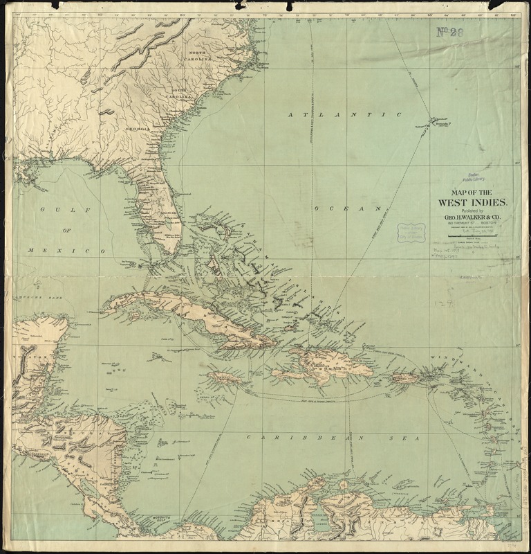
Map of the West Indies
Item Information
- Title:
- Map of the West Indies
- Creator:
- Geo. H. Walker & Co
- Date:
-
1898
- Format:
-
Maps/Atlases
- Location:
-
Boston Public Library
Norman B. Leventhal Map Center - Collection (local):
-
Norman B. Leventhal Map Center Collection
- Subjects:
-
Cables, Submarine--West Indies--Maps
Cables, Submarine--Caribbean Area--Maps
West Indies--Maps
Caribbean Area--Maps
- Places:
-
West Indies
Caribbean Sea
- Extent:
- 1 map : color ; 72 x 70 cm
- Terms of Use:
-
No known copyright restrictions.
No known restrictions on use.
- Publisher:
-
Boston :
Geo. H. Walker & Co.,
- Scale:
-
Scale approximately 1:4,900,000
- Language:
-
English
- Notes:
-
Relief shown by hachures and spot heights. Depths shown by soundings.
Also shows cables.
- Identifier:
-
06_01_011889
- Call #:
-
G4390 1898 .G46
- Barcode:
-
39999065690065


