Philips' sketch map of the Klondike gold region, Yukon district, Dominion of Canada : compiled from the latest authentic sources and from information supplied by the Klondyke Parent Pioneer Corporation
Item Information
- Title:
- Philips' sketch map of the Klondike gold region, Yukon district, Dominion of Canada : compiled from the latest authentic sources and from information supplied by the Klondyke Parent Pioneer Corporation
- Creator:
- George Philip & Son
- Date:
-
1898
- Format:
-
Maps/Atlases
- Location:
-
Boston Public Library
Norman B. Leventhal Map Center - Collection (local):
-
Norman B. Leventhal Map Center Collection
- Subjects:
-
Mining claims--Yukon--Klondike River Valley--Maps
Klondike River Valley (Yukon)--Maps
- Places:
-
CanadaKlondike (river)
- Extent:
- 1 map : color ; 81 x 108 cm
- Terms of Use:
-
No known copyright restrictions.
No known restrictions on use.
- Publisher:
-
London :
George Philip & Son,
- Scale:
-
Scale 1:126,720. 2 miles = 1 inch
- Language:
-
English
- Notes:
-
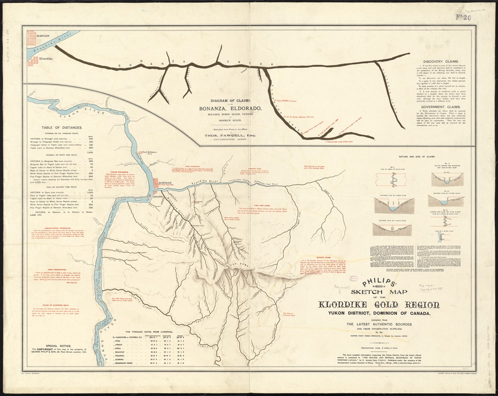
Relief shown by shading.
Inset: Diagram of claims on the Bonanza, Eldorado, Boulder, Byrne Gulch, Victoria and Skookum Gulch.
Includes notes, table of distances, through rates from Liverpool and diagrams showing nature and size of claims.
- Identifier:
-
06_01_011760
- Call #:
-
G3522.K44 1898 .G46
- Barcode:
-
39999065689380


