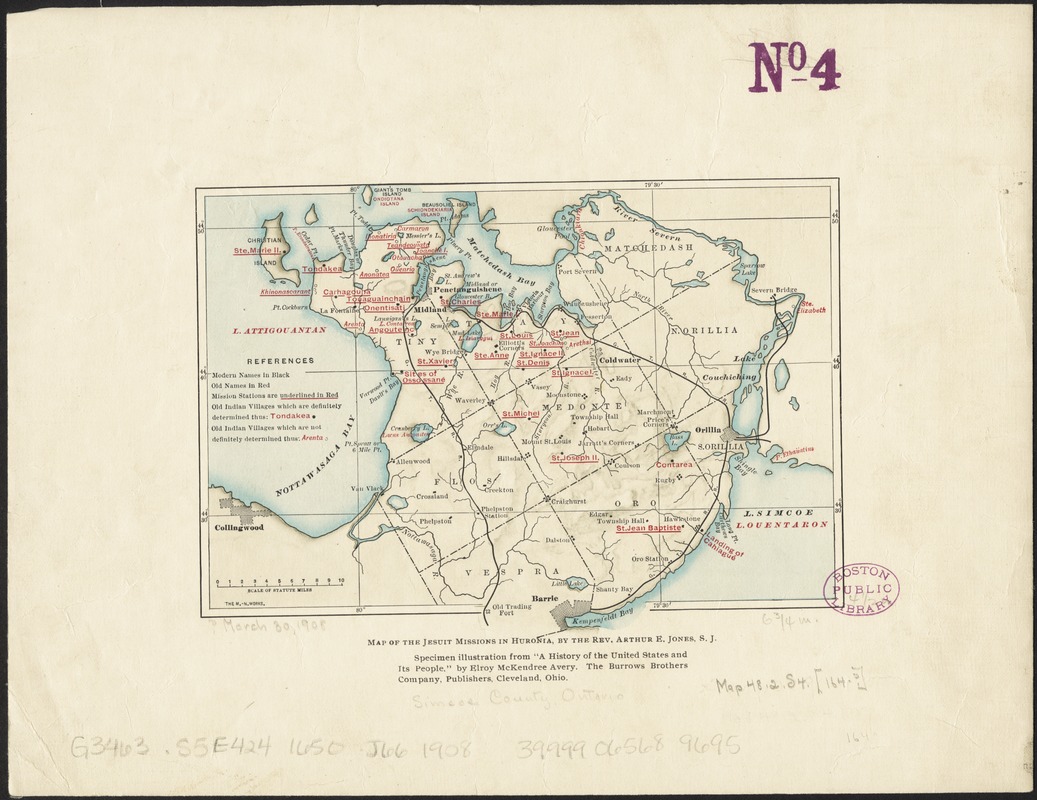
Map of the Jesuit missions in Huronia
Item Information
- Title:
- Map of the Jesuit missions in Huronia
- Creator:
- Jones, A. E. (Arthur Edward), 1838-1918
- Name on Item:
-
by the Rev. Arthur E. Jones, S.J.
- Date:
-
[1904–1908]
- Format:
-
Maps/Atlases
- Location:
-
Boston Public Library
Norman B. Leventhal Map Center - Collection (local):
-
Norman B. Leventhal Map Center Collection
- Subjects:
-
Jesuits--Missions--Ontario--Simcoe (County)--Maps
Wyandot Indians--Ontario--Simcoe (County)--Maps
Indians of North America--Ontario--Simcoe (County)--Maps
Simcoe (Ont. : County)--Maps
- Places:
-
Simcoe County
- Extent:
- 1 map : color ; 12 x 17 cm
- Terms of Use:
-
No known copyright restrictions.
No known restrictions on use.
- Publisher:
-
Cleveland, Ohio :
Burrows Brothers Company,
- Scale:
-
Scale approximately 1:490,000
- Language:
-
English
- Notes:
-
Shows mission stations, Indian villages and modern geography.
Relief shown by shading.
"Specimen illustration from 'A history of the United States and its people,' by Elroy McKendree Avery."
- Notes (date):
-
This date is inferred.
- Identifier:
-
06_01_011737
- Call #:
-
G3463.S5E424 1650 .J66 1908
- Barcode:
-
39999065689695


