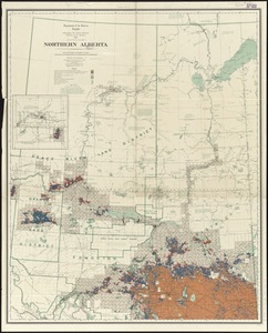
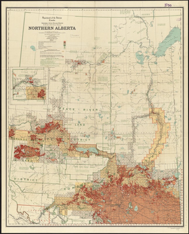
Northern Alberta : map showing disposition of lands
Item Information
- Title:
- Northern Alberta : map showing disposition of lands
- Creator:
- Canada. Natural Resources Intelligence Branch
- Name on Item:
-
prepared in the Natural Resources Intelligence Branch.
- Date:
-
1919
- Format:
-
Maps/Atlases
- Location:
-
Boston Public Library
Norman B. Leventhal Map Center - Collection (local):
-
Norman B. Leventhal Map Center Collection
- Subjects:
-
Petroleum--Alberta--Maps
Natural gas--Alberta--Maps
Land use--Alberta--Maps
Real property--Alberta--Maps
Alberta--Maps
- Places:
-
CanadaProvince of Alberta (province)
- Extent:
- 1 map : col. ; 104 x 84 cm.
- Terms of Use:
-
No known copyright restrictions.
No known restrictions on use.
- Publisher:
-
[Ottawa] :
Dept. of the Interior
- Edition:
- 12th ed.
- Scale:
-
Scale 1:792,000
- Language:
-
English
- Notes:
-
Relief shown by spot heights.
Inset: [western continuation].
Includes notes on soil, land, vegetation, and petroleum borings.
"Corrected to Sept. 1st 1919."
- Identifier:
-
06_01_011677
- Call #:
-
G3501.G4 1919 .C36
- Barcode:
-
39999065687285