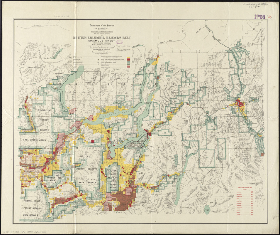
British Columbia railway belt : Sicamous sheet, west of sixth meridan : map showing the disposition of lands
Item Information
- Title:
- British Columbia railway belt : Sicamous sheet, west of sixth meridan : map showing the disposition of lands
- Creator:
- Canada. Department of the Interior
- Name on Item:
-
prepared under the direction of F.C.C.Lynch, superintendent of railway lands
- Date:
-
1913
- Format:
-
Maps/Atlases
- Location:
-
Boston Public Library
Norman B. Leventhal Map Center - Collection (local):
-
Norman B. Leventhal Map Center Collection
- Subjects:
-
Land use--British Columbia--Maps
Railroads--British Columbia--Maps
Sicamous (B.C.)--Maps
British Columbia--Maps
- Places:
-
CanadaProvince of British Columbia (province)Sicamous
- Extent:
- 1 map : color ; 65 x 80 cm
- Terms of Use:
-
No known copyright restrictions.
No known restrictions on use.
- Publisher:
-
Ottawa :
Department of the Interior
- Scale:
-
Scale 1:190,080
- Language:
-
English
- Notes:
-
Relief shown by hachures and spot heights.
"Corrected to September 1913."
In its British Columbia railway belt. Ottawa : Department of the Interior, 1913.
- Identifier:
-
06_01_011636
- Call #:
-
G3511.G4 1913 .C36
- Barcode:
-
30000005067043