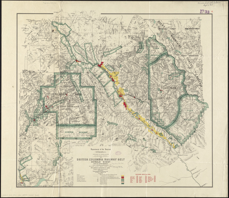
British Columbia railway belt : Donald sheet, west of fifth meridian : map showing disposition of lands
Item Information
- Title:
- British Columbia railway belt : Donald sheet, west of fifth meridian : map showing disposition of lands
- Creator:
- Canada. Department of the Interior
- Contributor:
- Lynch, Francis C. C.
- Name on Item:
-
prepared under the direction of F.C.C. Lynch, Superintendent of Railway Lands
- Date:
-
1913
- Format:
-
Maps/Atlases
- Location:
-
Boston Public Library
Norman B. Leventhal Map Center - Collection (local):
-
Norman B. Leventhal Map Center Collection
- Subjects:
-
Railroads--British Columbia--Columbia-Shuswap--Maps
Real property--British Columbia--Columbia-Shuswap--Maps
Columbia-Shuswap (B.C.)--Maps
- Places:
-
Columbia-Shuswap Regional District
- Extent:
- 1 map : color ; 67 x 75 cm
- Terms of Use:
-
No known copyright restrictions.
No known restrictions on use.
- Publisher:
-
Ottawa :
Department of the Interior
- Scale:
-
Scale 1:190,080
- Language:
-
English
- Notes:
-
Relief shown by hachures and spot heights.
Shows trails, post offices railroads and railway stations, range numbers, township numbers, homesteads, sales, special grangs, mining lands sales, lands disposed of by provincial government, forest reserves, timber berths, grazing leases and dominion parks.
"Corrected to September 1913."
In its British Columbia railway belt. Ottawa : Department of the Interior, 1913.
- Identifier:
-
06_01_011635
- Call #:
-
G3511.G4 1913 .C36
- Barcode:
-
30000005066869


