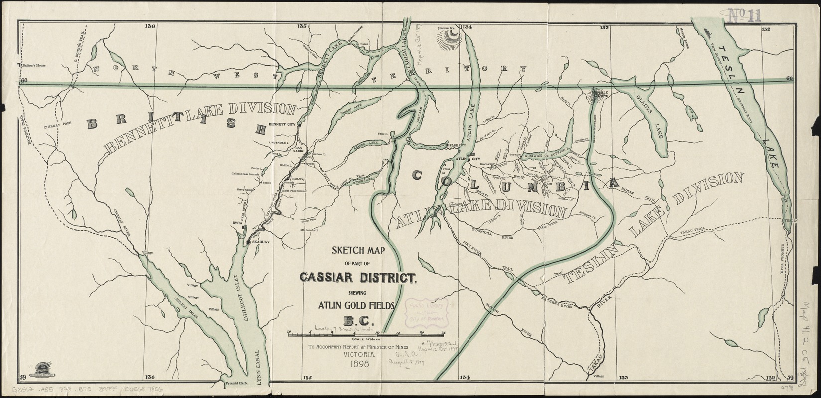
Sketch map of part of Cassiar District : shewing Atlin Gold Fields B.C. ; to accompany report of Minister of Mines Victoria 1898
Item Information
- Title:
- Sketch map of part of Cassiar District : shewing Atlin Gold Fields B.C. ; to accompany report of Minister of Mines Victoria 1898
- Creator:
- British Columbia. Minister of Mines' Office
- Printer:
- Province Publishing Co
- Date:
-
1898–1898
- Format:
-
Maps/Atlases
- Location:
-
Boston Public Library
Norman B. Leventhal Map Center - Collection (local):
-
Norman B. Leventhal Map Center Collection
- Subjects:
-
Gold mines and mining--British Columbia--Atlin Region--Maps
Gold mines and mining--British Columbia--Cassiar (District)--Maps
Atlin Region--Maps
Cassiar (B.C. : District)--Maps
- Places:
-
CanadaProvince of British Columbia (province)Atlin
Cassiar Land District
- Extent:
- 1 map : color ; 34 x 69 cm
- Terms of Use:
-
No known copyright restrictions.
No known restrictions on use.
- Publisher:
-
Victoria ; Victoria :
British Columbia Bureau of Mines, ; Lithographed by The Province Publishing Co. Ltp. Lty.,
- Scale:
-
Scale approximately 1:400,000
- Language:
-
English
- Notes:
-
Relief shown by hachures.
Shows camps and settlements.
- Identifier:
-
06_01_011621
- Call #:
-
G3512.A85 1898 .B75
- Barcode:
-
39999065687806


