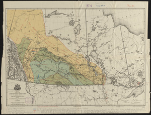
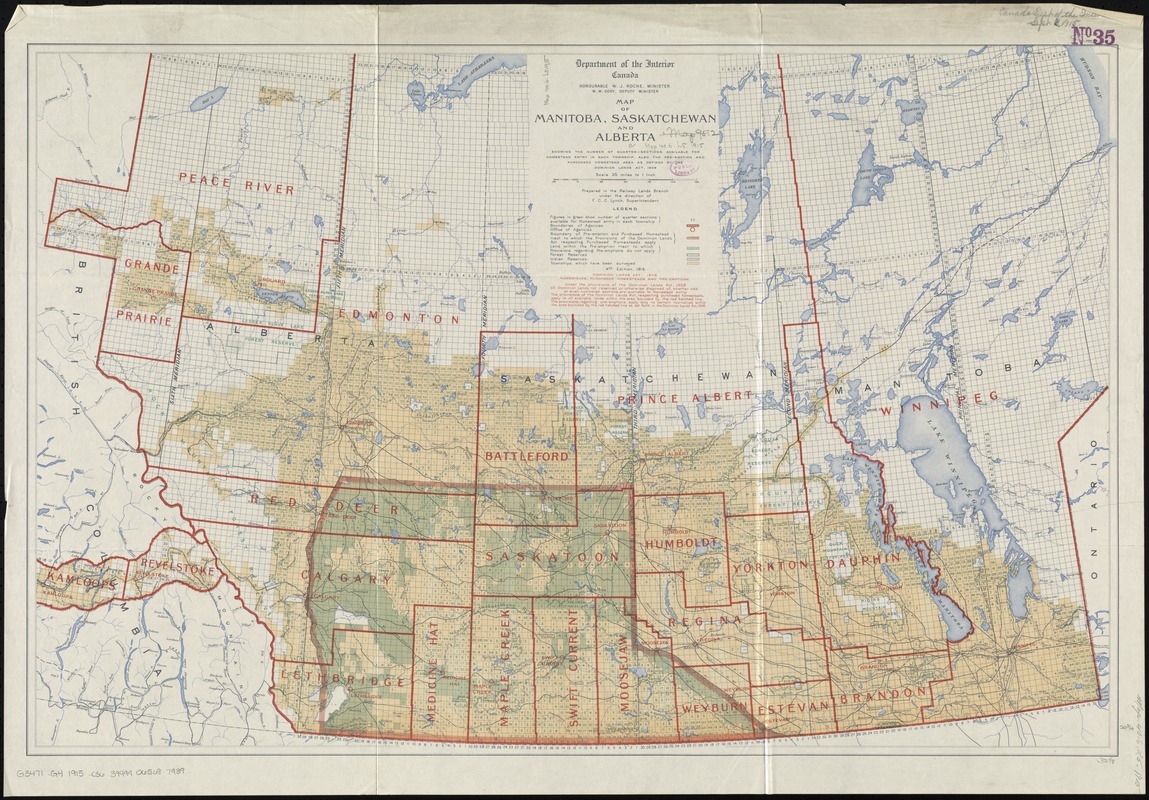
Map of Manitoba, Saskatchewan and Alberta : showing the number of quarter-sections available for homestead entry in each township, also the pre-emption and purchased homestead area as defined by the Dominion Lands Act, 1908
Item Information
- Title:
- Map of Manitoba, Saskatchewan and Alberta : showing the number of quarter-sections available for homestead entry in each township, also the pre-emption and purchased homestead area as defined by the Dominion Lands Act, 1908
- Creator:
- Canada. Railway Lands Branch
- Name on Item:
-
prepared in the Railway Lands Branch under the direction of F.C.C. Lynch, superintendent.
- Date:
-
1915
- Format:
-
Maps/Atlases
- Location:
-
Boston Public Library
Norman B. Leventhal Map Center - Collection (local):
-
Norman B. Leventhal Map Center Collection
- Subjects:
-
Land use--Prairie Provinces--Maps
Homestead law--Prairie Provinces--Maps
Prairie Provinces--Maps
- Places:
-
CanadaPrairies (area)
- Extent:
- 1 map : col. ; 53 x 82 cm.
- Terms of Use:
-
No known copyright restrictions.
No known restrictions on use.
- Publisher:
-
[Ottawa] :
Dept. of the Interior
- Edition:
- 4th ed.
- Scale:
-
Scale [1:2,217,600]. 35 mi. to 1 in.
- Language:
-
English
- Notes:
-
Shows number of quarter sections, boundaries of agencies, offices of agencies, homesteads to which provisions apply, forest reserves, indian reserves and townships surveyed.
Relief shown by hachures.
- Identifier:
-
06_01_011606
- Call #:
-
G3471.G4 1915 .C36
- Barcode:
-
39999065687939