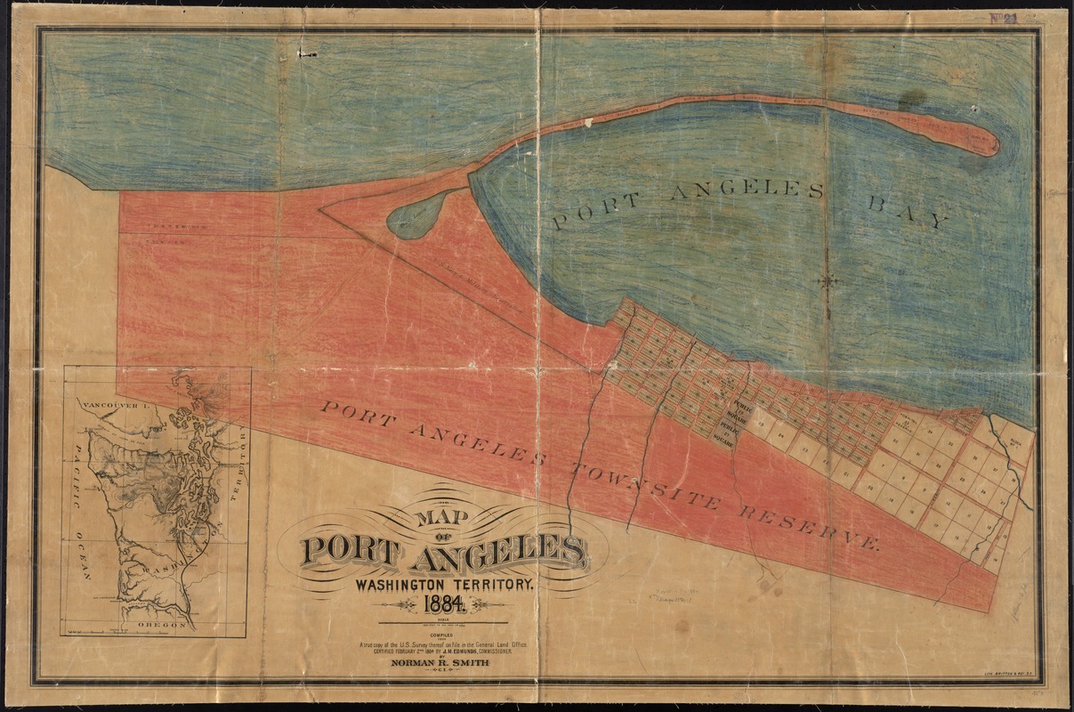
Map of Port Angeles, Washington Territory : compiled from a true copy of the U.S. survey thereof on file in the General Land Office, certified February 2nd 1864 by J.M. Edmunds, commissioner
Item Information
- Title:
- Map of Port Angeles, Washington Territory : compiled from a true copy of the U.S. survey thereof on file in the General Land Office, certified February 2nd 1864 by J.M. Edmunds, commissioner
- Creator:
- Smith, Norman R.
- Name on Item:
-
by Norman R. Smith, C.E.
- Date:
-
1884
- Format:
-
Maps/Atlases
- Location:
-
Boston Public Library
Norman B. Leventhal Map Center - Collection (local):
-
Norman B. Leventhal Map Center Collection
- Subjects:
-
Real property--Washington (State)--Port Angeles--Maps
Port Angeles (Wash.)--Maps
- Places:
-
Clallam (county)Port Angeles
- Extent:
- 1 map : hand colored ; 75 x 116 cm.
- Terms of Use:
-
No known copyright restrictions.
No known restrictions on use.
- Publisher:
-
S[an] F[rancisco] :
Britton & Rey
- Scale:
-
Scale 1:7,200
- Language:
-
English
- Notes:
-
Boston Public Library ms. colored in crayon.
Shows blocks, lots, public squares and reserves in 1864.
Inset: [Olympic Peninsula].
- Identifier:
-
06_01_011530
- Call #:
-
G4284.P5 1864 .S65 1884
- Barcode:
-
39999065686592


