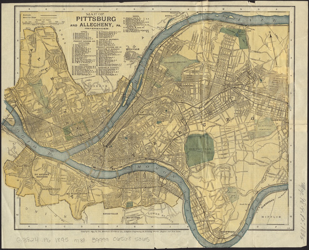
Map of Pittsburg and Allegheny, Pa
Item Information
- Title:
- Map of Pittsburg and Allegheny, Pa
- Creator:
- Matthews-Northrup Company
- Date:
-
[ca. 1895]
- Format:
-
Maps/Atlases
- Location:
-
Boston Public Library
Norman B. Leventhal Map Center - Collection (local):
-
Norman B. Leventhal Map Center Collection
- Subjects:
-
Pittsburgh (Pa.)--Maps
North Side (Pittsburgh, Pa.)--Maps
- Places:
-
Allegheny (county)Pittsburgh
North Side
- Extent:
- 1 map : col. ; 26 x 32 cm.
- Terms of Use:
-
No known copyright restrictions.
No known restrictions on use.
- Publisher:
-
Buffalo ; New York :
Matthews-Northrup Co.
- Scale:
-
Scale [1:42,240]. 1 mile = 1 1/2 inches
- Language:
-
English
- Notes:
-
Shows county boundaries, names of streets and points of interest, drainage, railroads and street car lines.
Includes references.
On verso: Index and text on Pittsburg with popluation census figure for 1890.
- Identifier:
-
06_01_011499
- Call #:
-
G3824.P6 1895 .M38
- Barcode:
-
39999065685065