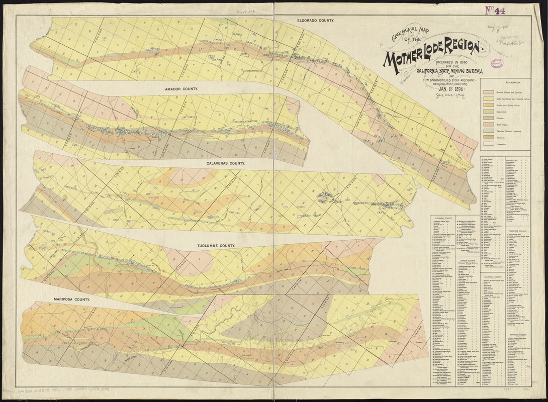
Geological map of the Mother Lode region
Item Information
- Title:
- Geological map of the Mother Lode region
- Title (alt.):
-
Mother Lode region
- Creator:
- Fairbanks, Harold W. (Harold Wellman), 1860-
- Name on Item:
-
prepared in 1890 for the California State Mining Bureau, by H.W. Fairbanks, B.S. field assistant.
- Date:
-
1896
- Format:
-
Maps/Atlases
- Location:
-
Boston Public Library
Norman B. Leventhal Map Center - Collection (local):
-
Norman B. Leventhal Map Center Collection
- Subjects:
-
Geology--California--Mother Lode--Maps
Gold mines and mining--California--Mother Lode--Maps
Mining claims--California--Mother Lode--Maps
Mother Lode (Calif.)--Maps
- Places:
-
Calaveras (county)Mother Lode Acres (area)
- Extent:
- 1 map in 5 sections : col. ; on sheet 62 x 86 cm.
- Terms of Use:
-
No known copyright restrictions.
No known restrictions on use.
- Publisher:
-
[Sacramento] :
California State Mining Bureau
- Edition:
- Reissued with additions Jan 1st 1896.
- Scale:
-
Scale [1:63,360]. 1 inch = 1 mile
- Language:
-
English
- Notes:
-
Covers parts of Eldorado, Amador, Calaveras, Tuolumne, and Mariposa Counties.
Oriented with north to the upper left.
Also shows mining claims.
Includes list of mining claims by counties.
Stamped: Compliments of Lewis E. Aubury, State Mineralogist.
First issued with the Mining Bureau's 10th annual report.
- Identifier:
-
06_01_011406
- Call #:
-
G4362.M83C5 1896 .F35
- Barcode:
-
39999065685909


