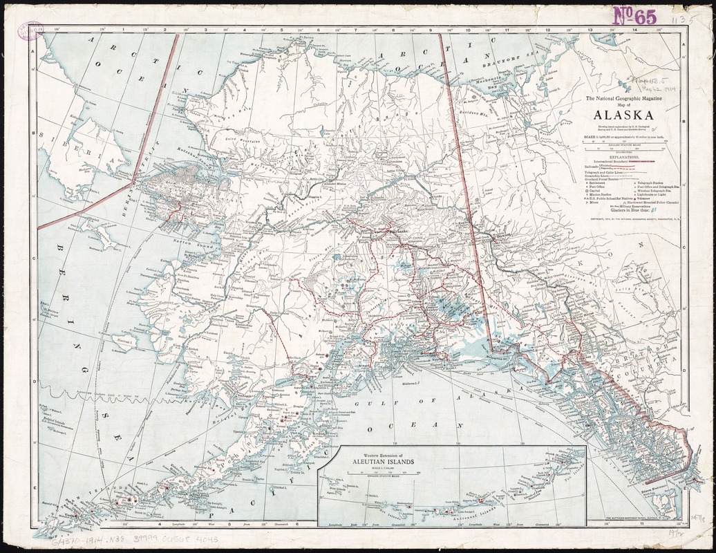
Map of Alaska : showing latest explorations by U.S. Geological Survey and U.S. Coast and Geodetic Survey
Item Information
- Title:
- Map of Alaska : showing latest explorations by U.S. Geological Survey and U.S. Coast and Geodetic Survey
- Title (alt.):
-
Alaska
National geographic magazine map of Alaska
- Creator:
- National Geographic Society (U.S.)
- Name on Item:
-
the National Geographic Magazine.
- Date:
-
[ca. 1914]
- Format:
-
Maps/Atlases
- Location:
-
Boston Public Library
Norman B. Leventhal Map Center - Collection (local):
-
Norman B. Leventhal Map Center Collection
- Subjects:
-
Railroads--Alaska--Maps
Volcanoes--Alaska--Maps
Alaska--Maps
- Places:
-
Alaska
- Extent:
- 1 map : col. ; 39 x 53 cm.
- Terms of Use:
-
No known copyright restrictions.
No known restrictions on use.
- Publisher:
-
Washington, D.C :
National Geographic Society
- Scale:
-
Scale 1:5,000,000 or approx. 80 miles to 1 in.
- Language:
-
English
- Notes:
-
Also shows railroads and volcanos over printed in red.
Relief shown by hachures and spot heights.
Inset: Western extension of Aleutian Islands.
- Identifier:
-
06_01_011397
- Call #:
-
G4370 1914 .N38
- Barcode:
-
39999065684043


