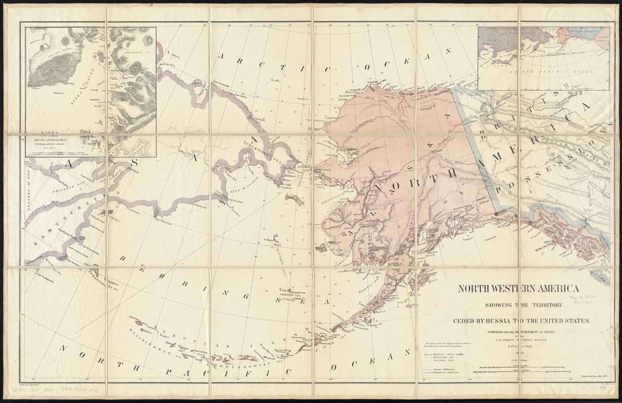
North western America showing the territory ceded by Russia to the United States
Item Information
- Title:
- North western America showing the territory ceded by Russia to the United States
- Title (alt.):
-
Northwestern America showing the territory ceded by Russia to the United States
- Creator:
- United States Coast Survey
- Name on Item:
-
compiled for the Department of State at the U.S. Coast Survey office, B. Peirce, Supt. ; drawn by A. Lindenkohl.
- Date:
-
1867
- Format:
-
Maps/Atlases
- Location:
-
Boston Public Library
Norman B. Leventhal Map Center - Collection (local):
-
Norman B. Leventhal Map Center Collection
- Subjects:
-
Alaska--Maps
Sitka (Alaska)--Maps
- Places:
-
AlaskaSitka
- Extent:
- 1 map : col. ; 54 x 90 cm.
- Terms of Use:
-
No known copyright restrictions.
No known restrictions on use.
- Publisher:
-
Washington, D.C :
United States Coast Survey
- Edition:
- 2nd ed.
- Scale:
-
Scale 1:5,000,000
- Language:
-
English
- Notes:
-
Relief shown by hachures and spot heights. Depths shown by soundings and isolines.
"Second edition, May 1867."
Shows Russian and Eskimo settlements.
Insets: Sitka and its approaches -- location map.
- Identifier:
-
06_01_011366
- Call #:
-
G4370 1867 .U551
- Barcode:
-
39999065684423


