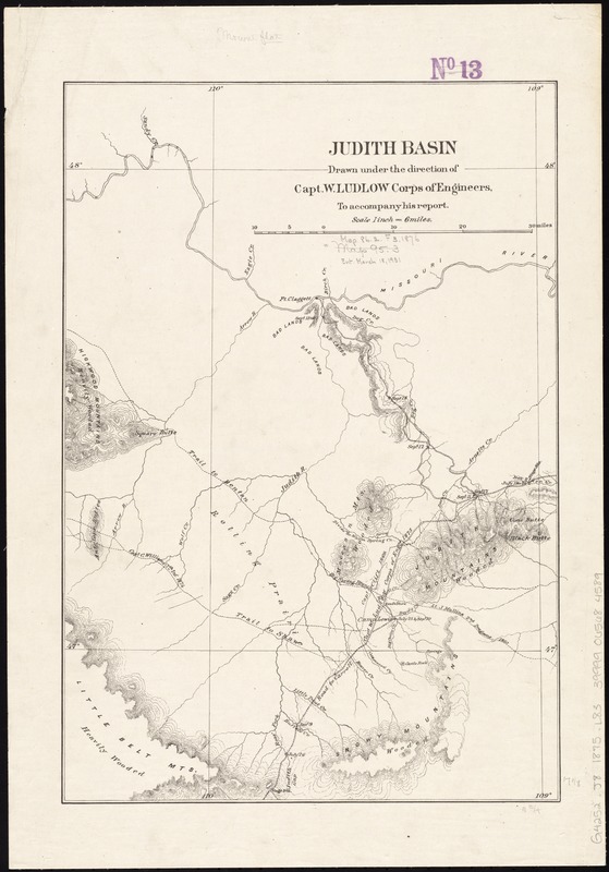
Judith Basin
Item Information
- Title:
- Judith Basin
- Creator:
- Ludlow, William, 1843-1901
- Name on Item:
-
drawn under the direction of Capt. W. Ludlow, Corps of Engineers, to accompany his report.
- Date:
-
[1876]
- Format:
-
Maps/Atlases
- Location:
-
Boston Public Library
Norman B. Leventhal Map Center - Collection (local):
-
Norman B. Leventhal Map Center Collection
- Subjects:
-
Judith River Watershed (Mont.)--Maps
Judith Basin (Mont.)--Maps
- Places:
-
Judith (river)
- Extent:
- 1 map ; 44 x 30 cm.
- Terms of Use:
-
No known copyright restrictions.
No known restrictions on use.
- Publisher:
-
Washington, D.C :
Corps. of Engineers
- Scale:
-
Scale [1:380,160]. 1 in. = 6 miles.
- Language:
-
English
- Notes:
-
Relief shown by form lines.
Shows drainage, trails, etc.
From his Report of a reconnaissance from Carroll, Montana Territory, on the upper Missouri, to the Yellowstone National Park, and return, made in the summer of 1875. 1876.
- Notes (date):
-
This date is inferred.
- Identifier:
-
06_01_011363
- Call #:
-
G4252.J8 1875 .L83
- Barcode:
-
39999065684589


