Map of Denison, Crawford County, Iowa
Item Information
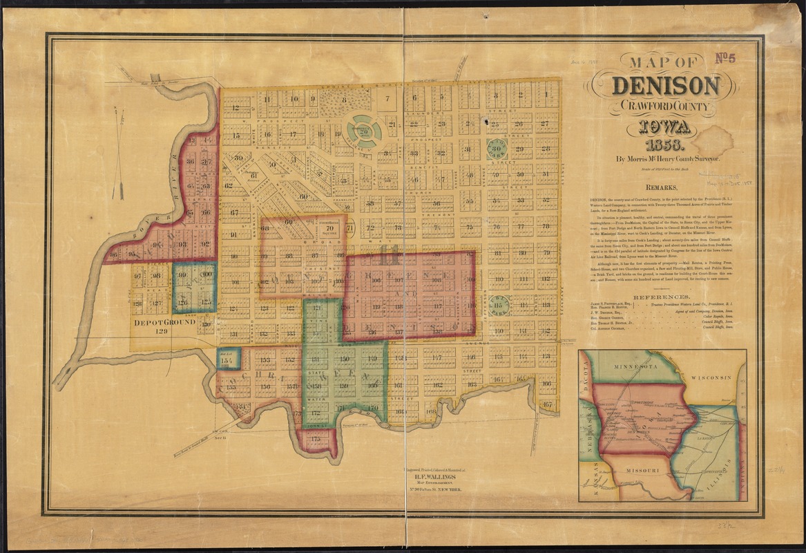
- Title:
- Map of Denison, Crawford County, Iowa
- Creator:
- McHenry, Morris.
- Name on Item:
-
by Morris McHenry, County Surveyor ; engraved, printed, colored & mounted at H.F. Wallings Map Establishment.
- Date:
-
1858
- Format:
-
Maps/Atlases
- Location:
-
Boston Public Library
Norman B. Leventhal Map Center - Collection (local):
-
Norman B. Leventhal Map Center Collection
- Subjects:
-
Denison (Iowa)--Maps
- Places:
-
Crawford (county)Denison
- Extent:
- 1 map : col. ; 57 x 86 cm.
- Terms of Use:
-
No known copyright restrictions.
No known restrictions on use.
- Publisher:
-
New York :
H.F. Wallings
- Scale:
-
Scale [1:3,840]. 1 in. = 320 feet
- Language:
-
English
- Notes:
-
Includes remarks, references and regional map.
- Identifier:
-
06_01_011267
- Call #:
-
G4154.D4 1858 .M34
- Barcode:
-
39999065683730


