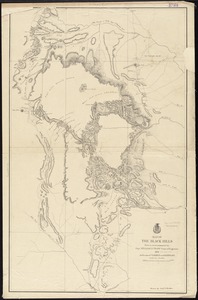
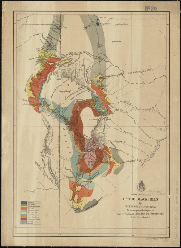
A geological map of the Black Hills
Item Information
- Title:
- A geological map of the Black Hills
- Creator:
- Winchell, N. H. (Newton Horace), 1839-1914
- Name on Item:
-
by Professor N.H. Winchell ; to accompany the report of Capt. William Ludlow, U.S. Engineers.
- Date:
-
[1875]
- Format:
-
Maps/Atlases
- Location:
-
Boston Public Library
Norman B. Leventhal Map Center - Collection (local):
-
Norman B. Leventhal Map Center Collection
- Subjects:
-
Geology--Black Hills (S.D. and Wyo.)--Maps
Black Hills (S.D. and Wyo.)--Maps
- Places:
-
Black Hills (mountain)
- Extent:
- 1 map : col. ; 63 x 43 cm.
- Terms of Use:
-
No known copyright restrictions.
No known restrictions on use.
- Publisher:
-
Washington :
U.S. Engineers
- Scale:
-
Scale [1:380,160]. 1 in. = 6 miles
- Language:
-
English
- Notes:
-
Shows survey expedition routes, dates and leaders' names.
Relief shown by hachures.
- Notes (date):
-
This date is inferred.
- Identifier:
-
06_01_011256
- Call #:
-
G4182.B5C5 1875 .W56
- Barcode:
-
39999065683946