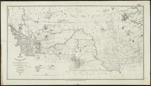
Official map of the territory of Dakota, showing the two general divisions of Dakota, South and North, the land districts, Indian reservations, counties, towns and railroads
Item Information
- Title:
- Official map of the territory of Dakota, showing the two general divisions of Dakota, South and North, the land districts, Indian reservations, counties, towns and railroads
- Description:
-
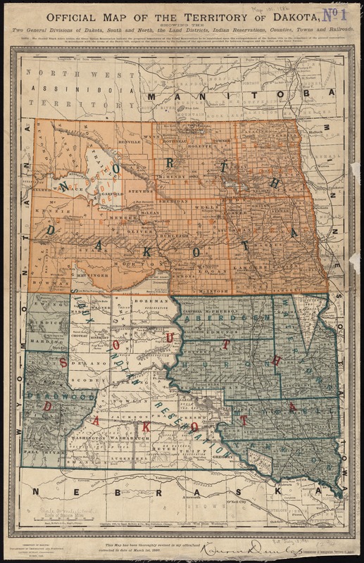
The original Great Sioux Reservation was established as part of the Fort Laramie Treaty of April 29, 1868, and initially comprised all of South Dakota west of the Missouri River. The map displayed here illustrates the extent of the reservation in 1886, after the sacred Black Hills were taken from the Great Sioux Reservation, which the U.S. Supreme Court deemed "unfair and dishonorable" in 1980. The Black Hills were appropriated by the United States government due to an abundance of mineral resources – mainly gold and silver – found there. As tribal lands were continually reduced, they were separated into six smaller reservations, including the Standing Rock Sioux Reservation.
- Creator:
- Dakota Territory. Department of Immigration and Statistics
- Name on Item:
-
Territory of Dakota: Department of Immigration and Statistics.
- Date:
-
1886
- Format:
-
Maps/Atlases
- Location:
-
Boston Public Library
Norman B. Leventhal Map Center - Collection (local):
-
Norman B. Leventhal Map Center Collection
- Subjects:
-
Indians of North America--Dakota Territory--Maps
Indian reservations--Dakota Territory--Maps
Dakota Territory--Maps
North Dakota--Maps
South Dakota--Maps
- Places:
-
North Dakota
South Dakota
- Extent:
- 1 map : col. ; 56 x 32 cm.
- Terms of Use:
-
No known copyright restrictions.
No known restrictions on use.
- Publisher:
-
Chicago :
Rand McNally & Co.
- Scale:
-
Scale [ca. 1:1,960,000]
- Language:
-
English
- Notes:
-
Relief shown by hachures.
Prime meridians: Greenwich and Washington.
"This map has been thoroughly revised in my office, and corrected to date of March 1st, 1886."
- Notes (exhibitions):
-
Exhibited: "Beneath Our Feet: Mapping the World Below" organized by the Norman B. Leventhal Map Center at the Boston Public Library, 2017-2018.
- Identifier:
-
06_01_011330
- Call #:
-
G4170 1886 .D35
- Barcode:
-
39999065684928