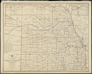
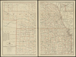
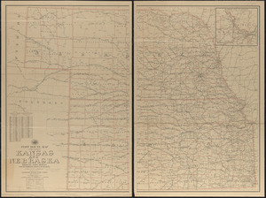
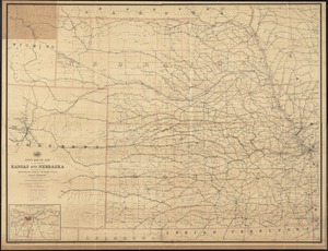
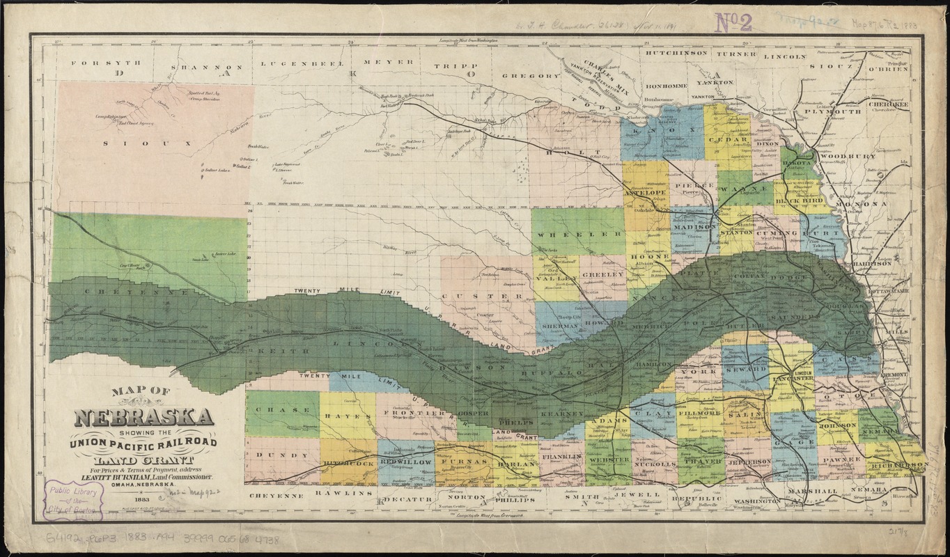
Map of Nebraska showing the Union Pacific Railroad land grant
Item Information
- Title:
- Map of Nebraska showing the Union Pacific Railroad land grant
- Creator:
- August Gast & Co
- Name on Item:
-
Aug. Gast & Co., St. Louis.
- Date:
-
1883
- Format:
-
Maps/Atlases
- Location:
-
Boston Public Library
Norman B. Leventhal Map Center - Collection (local):
-
Norman B. Leventhal Map Center Collection
- Subjects:
-
Union Pacific Railroad Company--Maps
Railroads--Nebraska--Maps
Railroad land grants--Nebraska--Platte River--Maps
Nebraska--Maps
- Places:
-
Nebraska
- Extent:
- 1 map : col. ; 31 x 58 cm.
- Terms of Use:
-
No known copyright restrictions.
No known restrictions on use.
- Publisher:
-
St. Louis, Mo :
Aug. Gast & Co.
- Scale:
-
Scale [ca. 1:1,300,000]
- Language:
-
English
- Notes:
-
Relief shown by hachures.
Shows "Twenty mile limit" railroad right-of-way and lands along either side of the railroad, which follows the Platte River.
"For prices & terms of payment address Leavitt Burnham, Land Commissioner, Omaha, Nebraska."
- Identifier:
-
06_01_011344
- Call #:
-
G4192.P6P3 1883 .A94
- Barcode:
-
39999065684738