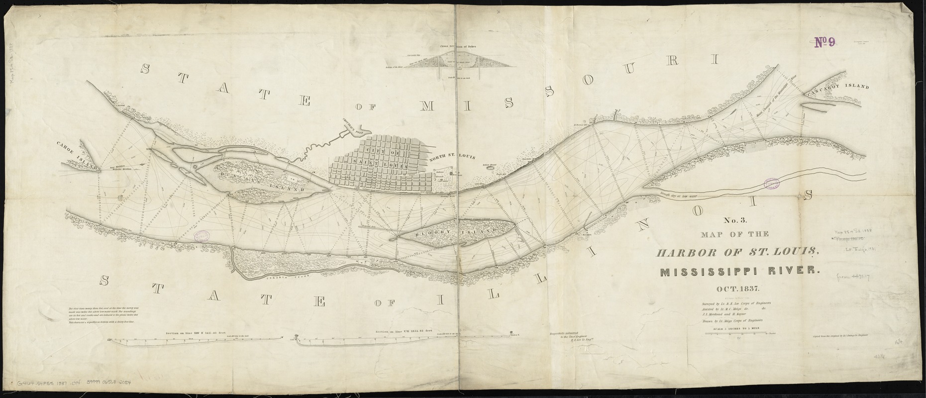
Map of the harbor of St. Louis, Mississippi River, Oct. 1837
Item Information
- Title:
- Map of the harbor of St. Louis, Mississippi River, Oct. 1837
- At head of title :
- No. 3
- Creator:
- Lee, Robert E. (Robert Edward), 1807-1870
- Name on Item:
-
surveyed by Lt. R.E. Lee, Corps of Engineers ; assisted by Lt. M.C. Meigs do. do. ; J.S. Morehead and H. Kayser ; drawn by Lt. Meigs, Corps of Engineers ; copied from the original by M.C. Ewing, civ. engineer ;W.J. Stone, sc.
- Date:
-
[1837]
- Format:
-
Maps/Atlases
- Location:
-
Boston Public Library
Norman B. Leventhal Map Center - Collection (local):
-
Norman B. Leventhal Map Center Collection
- Subjects:
-
Harbors--Missouri--Saint Louis--Maps
Saint Louis (Mo.)--Maps
- Places:
-
Saint Louis
- Extent:
- 1 map ; 51 x 119 cm.
- Terms of Use:
-
No known copyright restrictions.
No known restrictions on use.
- Publisher:
-
Washington :
U.S. Army, Corps of Engineers
- Scale:
-
Scale [ca. 1:316,800]
- Language:
-
English
- Notes:
-
Relief shown pictorially. Depths shown by isolines and soundings.
Oriented with north to the right.
Includes 3 profiles.
"25 Congress 2 Session, S. Doc. 139."
- Notes (date):
-
This date is inferred.
- Identifier:
-
06_01_011248
- Call #:
-
G4164.S4P55 1837 .L44
- Barcode:
-
39999065682054
- LCCN:
-
78692255