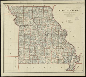
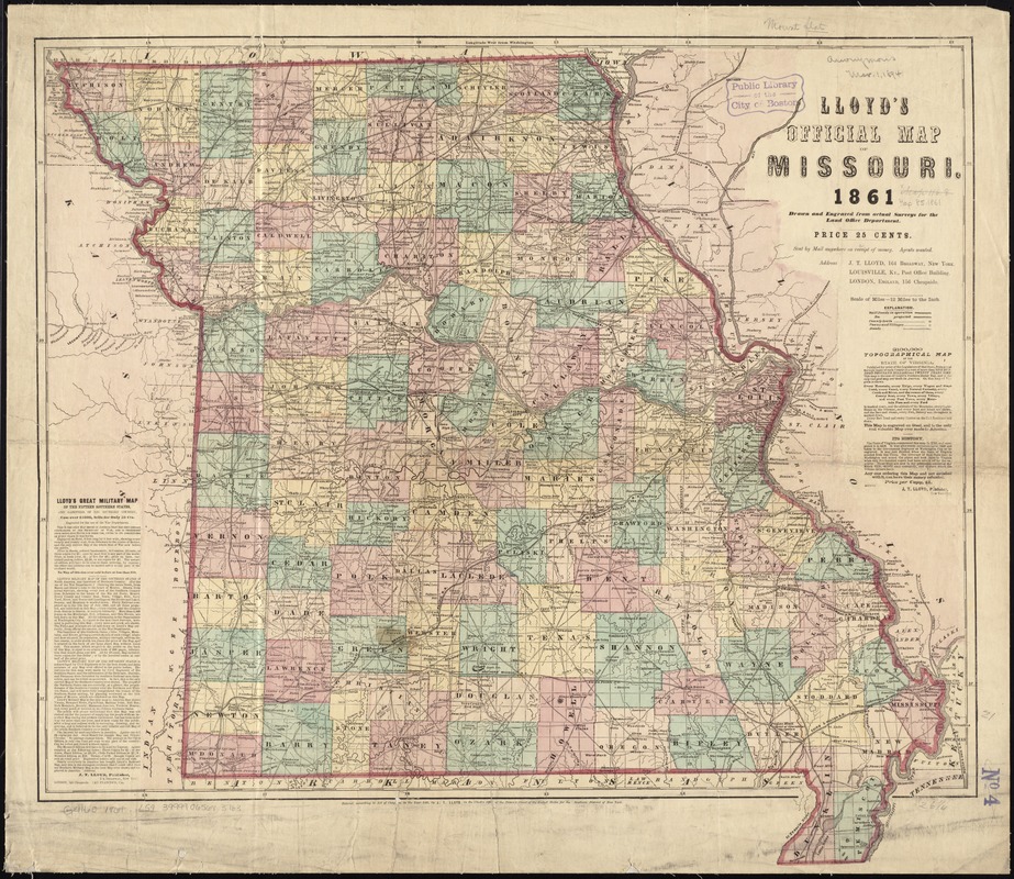
Lloyd's official map of Missouri
Item Information
- Title:
- Lloyd's official map of Missouri
- Title (alt.):
-
Official map of Missouri
- Creator:
- Lloyd, James T.
- Name on Item:
-
drawn and engraved from actual surveys for the Land Office Department.
- Date:
-
1861
- Format:
-
Maps/Atlases
- Location:
-
Boston Public Library
Norman B. Leventhal Map Center - Collection (local):
-
Norman B. Leventhal Map Center Collection
- Subjects:
-
Missouri--Administrative and political divisions--Maps
Missouri--Maps
- Places:
-
Missouri
- Extent:
- 1 map : hand col. ; 60 x 67 cm.
- Terms of Use:
-
No known copyright restrictions.
No known restrictions on use.
- Publisher:
-
New York :
J.T. Lloyd
- Scale:
-
Scale [1:760,320]. 12 miles to the in.
- Language:
-
English
- Notes:
-
Also shows county boundaries, drainage, roads and railroads.
"Entered, according to Act of Congress, in the year 1861, by J.T. Lloyd, in the Clerk's Office of the District Court of the United States for the Southern District of New York."
Includes text.
- Identifier:
-
06_01_011270
- Call #:
-
G4160 1861 .L59
- Barcode:
-
39999065683763