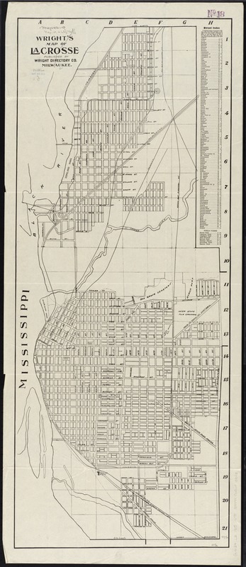
Wright's map of La Crosse
Item Information
- Title:
- Wright's map of La Crosse
- Title (alt.):
-
Map of La Crosse
- Date:
-
[1915?]
- Format:
-
Maps/Atlases
- Location:
-
Boston Public Library
Norman B. Leventhal Map Center - Collection (local):
-
Norman B. Leventhal Map Center Collection
- Subjects:
-
La Crosse (Wis.)--Maps
- Places:
-
La Crosse (county)La Crosse
- Extent:
- 1 map ; 96 x 39 cm.
- Terms of Use:
-
No known copyright restrictions.
No known restrictions on use.
- Publisher:
-
Milwaukee :
Wright Directory Co.
- Scale:
-
Scale [ca. 1:9,000]
- Language:
-
English
- Notes:
-
Includes street index.
Points of interest include parks, railroads, cemeteries, the bridge over Black River at Copeland Park, Burns Park, Cameron Park, Copeland Park, Inter State Fair Grounds, Myrick Park, State Normal School, Riverside Park, Spence Park, Oak Grove Cemetery, La Crosse River old and new channels, Convent, Hospital, John Gund Brewing Company.
- Identifier:
-
06_01_011295
- Call #:
-
G4124.L2 1915 .W75
- Barcode:
-
39999065683383