Military map of the United States & territories showing the location of the military posts, arsenals, Navy yards, & ports of entry : compiled from pub_document
Item Information
- Title:
- Military map of the United States & territories showing the location of the military posts, arsenals, Navy yards, & ports of entry : compiled from pub_document
- Title (alt.):
-
Military map of the United States and territories showing the location of the military posts, arsenals, Navy yards, and ports of entry
- Creator:
- P.S. Duval & Son
- Date:
-
1861
- Format:
-
Maps/Atlases
- Location:
-
Boston Public Library
Norman B. Leventhal Map Center - Collection (local):
-
Norman B. Leventhal Map Center Collection
- Subjects:
-
United States--History--Civil War, 1861-1865--Maps
- Places:
-
- Extent:
- 1 map : hand col. ; 53 x 76 cm.
- Terms of Use:
-
No known copyright restrictions.
No known restrictions on use.
- Publisher:
-
Phila :
P.S. Duval & Son
- Scale:
-
Scale [ca. 1:14,000,000]
- Language:
-
English
- Notes:
-
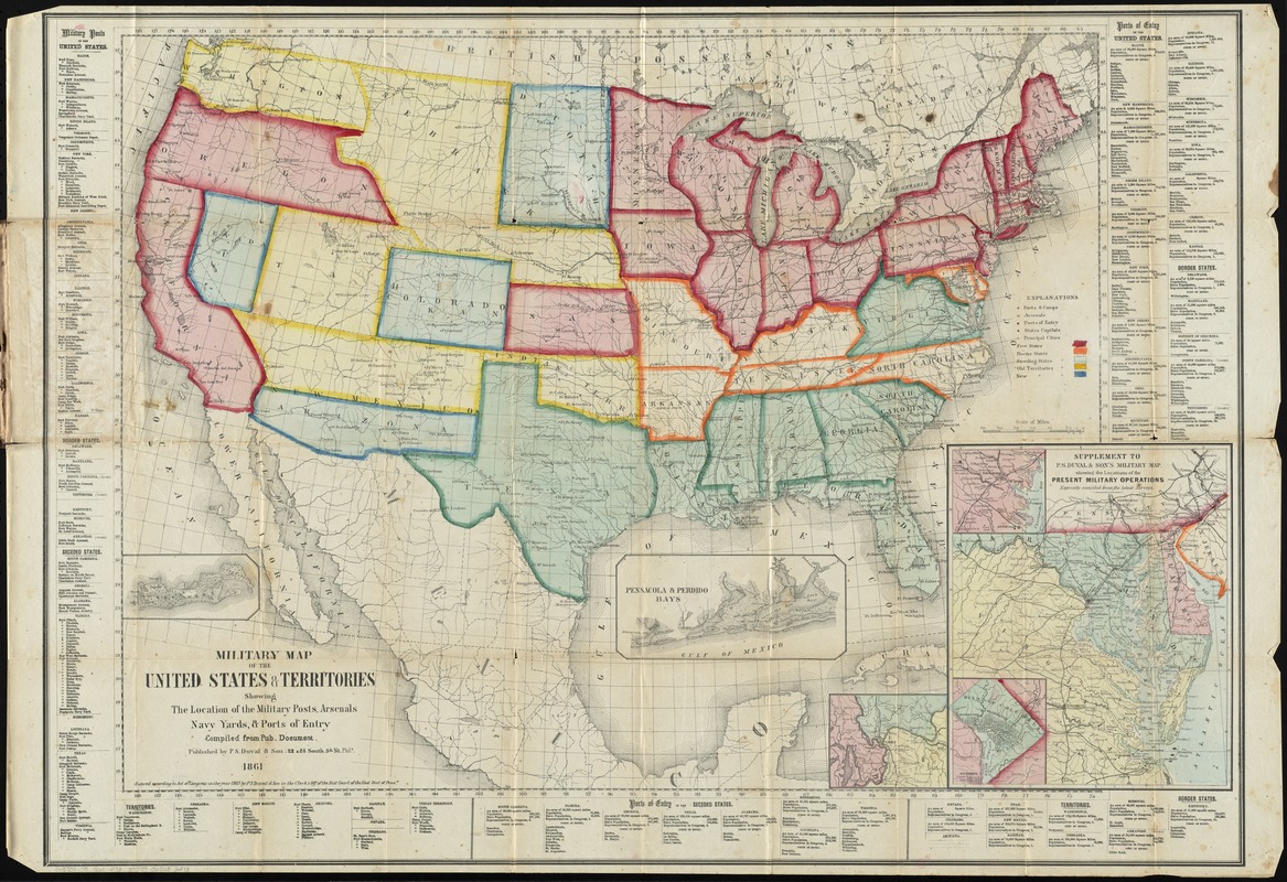
Shows the U.S. some time between April 17, 1861 when Virginia seceded and May 6, 1861 when Arkansas seceded. Indicates free states, border states, seceding states, old territories, and new territories. Map shows state capitals and principal towns, drainage, geographic coordinates, and names and boundaries of the states and territories
Military posts and ports of entry are listed at bottom and sides of map.
Insets: Key West -- Pensacola & Perdido Bays -- [Cairo, Illinois and surrounding area] -- Supplement to P.S. Duval & Son's military map showing the locations of the present military operations, expressly compiled from the latest surveys.
"Entered according to Act of Congress in the year 1861 by P.S. Duval & Son in the Clerk's Office of the Dist. Court of the East. Dist. of Penna."
- Identifier:
-
06_01_011214
- Call #:
-
G3701.S5 1861 .P73
- Barcode:
-
39999065682278
- LCCN:
-
99447019


