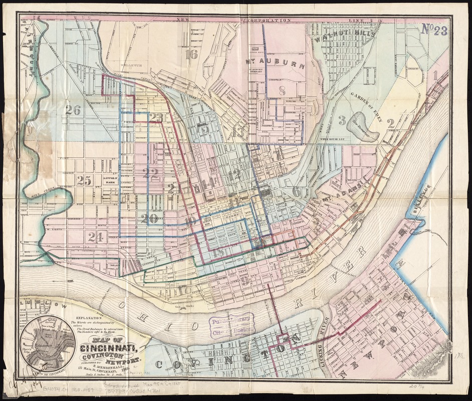
Map of Cincinnati, Covington and Newport
Item Information
- Title:
- Map of Cincinnati, Covington and Newport
- Date:
-
1868
- Format:
-
Maps/Atlases
- Location:
-
Boston Public Library
Norman B. Leventhal Map Center - Collection (local):
-
Norman B. Leventhal Map Center Collection
- Subjects:
-
Cincinnati (Ohio)--Maps
Covington (Ky.)--Maps
Newport (Ky.)--Maps
- Places:
-
Hamilton (county)Cincinnati
Kenton (county)Covington
Campbell (county)Newport
- Extent:
- 1 map : col. ; 45 x 53 cm.
- Terms of Use:
-
No known copyright restrictions.
No known restrictions on use.
- Publisher:
-
Cincinnati :
E. Mendenhall
- Scale:
-
Scale [1:10,560]. 6 inches to 1 mile
- Language:
-
English
- Notes:
-
Relief shown by hachures.
Also shows wards.
Includes location map.
- Identifier:
-
06_01_011346
- Call #:
-
G4084.C4 1868 .M37
- Barcode:
-
39999065684761