Map of Medina Co., Ohio
Item Information
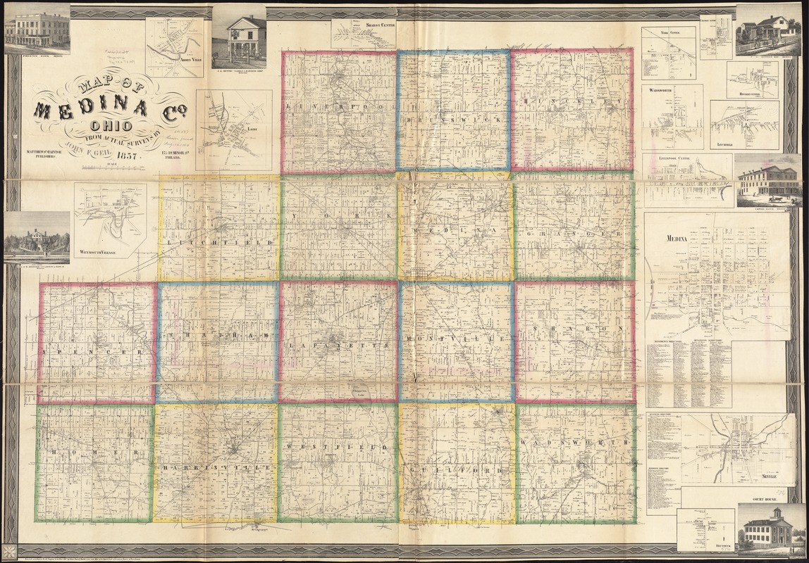
- Title:
- Map of Medina Co., Ohio
- Creator:
- Geil, John F.
- Name on Item:
-
from actual surveys by John F. Geil.
- Date:
-
1857
- Format:
-
Maps/Atlases
- Location:
-
Boston Public Library
Norman B. Leventhal Map Center - Collection (local):
-
Norman B. Leventhal Map Center Collection
- Subjects:
-
Landowners--Ohio--Medina County--Maps
Real property--Ohio--Medina County--Maps
Buildings--Ohio--Medina County--Pictorial works
Cities and towns--Ohio--Medina County--Maps
Medina County (Ohio)--Maps
- Places:
-
Medina (county)
- Extent:
- 1 map on 2 sheets : hand color ; 100 x 147 cm, sheets 54 x 154 cm
- Terms of Use:
-
No known copyright restrictions.
No known restrictions on use.
- Publisher:
-
Philada :
Matthews and Taintor Publishers
- Scale:
-
Scale approximately 1:36,000
- Language:
-
English
- Notes:
-
BPL copy assembled, sectioned into 3 pieces and mounted on cloth.
"Entered according to Act of Congress in the year 1854 by Robert Pearsall Smith in the Clerks Office of the District Court of the Eastern Court of Pennsylvania."
Includes residence and business directories, 13 insets, and 6 illustrations of buildings.
Insets: Abbey Ville -- Lodi -- Weymouth Village -- Sharon Center -- York Centre -- Chatham Centre -- Wadsworth -- Hinckley Center -- Litchfield -- Liverpool Centre -- Medina -- Seville -- Brunswick.
- Identifier:
-
06_01_011289
- Call #:
-
G4083.M4 1857 .G45
- Barcode:
-
39999065683557
- LCCN:
-
2012592378


