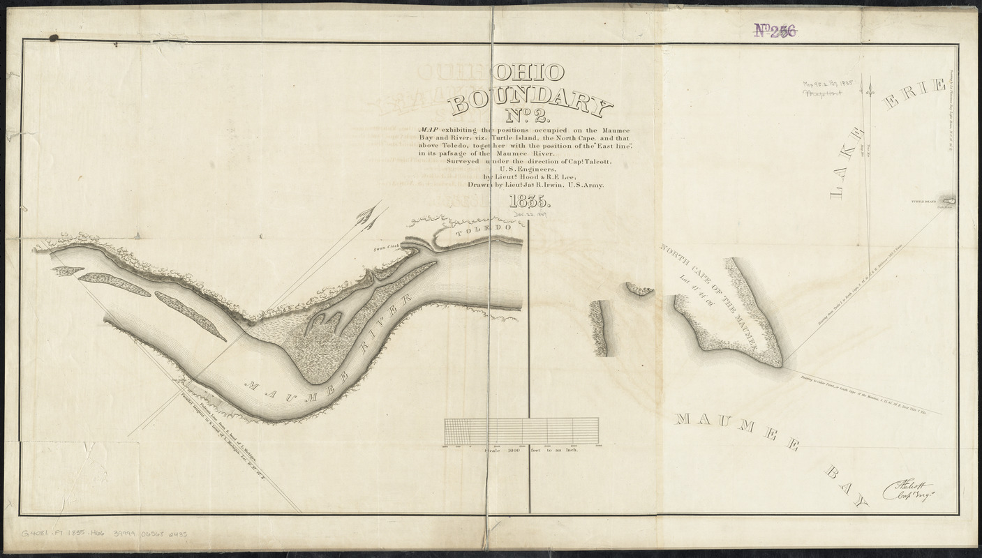
Ohio boundary no. 2 : map exhibiting the positions occupied on the Maumee Bay and river: viz: Turtle Island, the North Cape, and that above Toledo, together with the position of the "east line," in its passage of the Maumee River surveyed under the direction of Capt. Talcott, U.S. Engineers, by Lieuts. Hood & R.E. Lee
Item Information
- Title:
- Ohio boundary no. 2 : map exhibiting the positions occupied on the Maumee Bay and river: viz: Turtle Island, the North Cape, and that above Toledo, together with the position of the "east line," in its passage of the Maumee River surveyed under the direction of Capt. Talcott, U.S. Engineers, by Lieuts. Hood & R.E. Lee
- Creator:
- Irwin, James R., -1848
- Contributor:
- Hood, Washington
- Contributor:
- Lee, Robert E. (Robert Edward), 1807-1870
- Contributor:
- Talcott, Andrew, 1797-1883
- Contributor:
- United States. Army. Corps of Engineers
- Name on Item:
-
drawn by Lieut. Jas. R. Irwin, U.S. Army 1835
- Date:
-
1835
- Format:
-
Maps/Atlases
- Location:
-
Boston Public Library
Norman B. Leventhal Map Center - Collection (local):
-
Norman B. Leventhal Map Center Collection
- Subjects:
-
Lucas County (Ohio)--Maps
Maumee River (Ind. and Ohio)--Maps
Erie, Lake--Maps
Toledo (Ohio)--Maps
Michigan--Boundaries--Ohio--Maps
Ohio--Boundaries--Michigan--Maps
- Places:
-
Maumee River
Lucas (county)Toledo
Erie, Lake
- Extent:
- 2 maps on 1 sheet ; 47 x 51 cm. and 47 x 41 cm., on sheet 55 x 98 cm.
- Terms of Use:
-
No known copyright restrictions.
No known restrictions on use.
- Publisher:
-
[Washington, D.C.] :
[U.S. Congress]
- Scale:
-
Scale [1:12,000]
Scale [1:12,000]
- Language:
-
English
- Notes:
-
Relief shown by hachures and land forms.
Shows portion of the Maumee River south of Toledo, Ohio; portion of the North Cape of the Maumee in Maumee Bay in Lake Erie.
From: Ohio and Michigan boundary ..., 1836. (Ex. Doc./HR 24th Congress, 1st Session, no. 54).
In lower right corner: [signed] A. Talcott capt engr.
- Identifier:
-
06_01_011203
- Call #:
-
G4081.F7 1835 .H66
- Barcode:
-
30000004186498


