Ohio boundary no. 1 South Bend of Lake Michigan : map, exhibiting the position occupied in the determination of the latitude of the extreme south bend of Lake Michigan
Item Information
- Title:
- Ohio boundary no. 1 South Bend of Lake Michigan : map, exhibiting the position occupied in the determination of the latitude of the extreme south bend of Lake Michigan
- Title (alt.):
-
Map exhibiting the position occupied in the determination of the latitude of the extreme south bend of Lake Michigan
South bend of Lake Michigan
- Creator:
- Hood, Washington
- Contributor:
- Smith, William, Lieutenant
- Contributor:
- Talcott, Andrew, 1797-1883
- Contributor:
- United States. Army. Corps of Engineers
- Name on Item:
-
surveyed under the direction of Capt. A. Talcott, United States Engrs., by Lieuts. W. Hood & Willm. Smith ; Lt. W. Hood, del.
- Date:
-
1835
- Format:
-
Maps/Atlases
- Location:
-
Boston Public Library
Norman B. Leventhal Map Center - Collection (local):
-
Norman B. Leventhal Map Center Collection
- Subjects:
-
Lake County (Ind.)--Maps
Michigan--Boundaries--Ohio--Maps
Ohio--Boundaries--Michigan--Maps
Ohio--Surveys--Maps
Michigan, Lake--Surveys--Maps
- Places:
-
Michigan, Lake
Lake (county)
- Extent:
- 1 map ; 32 x 75 cm.
- Terms of Use:
-
No known copyright restrictions.
No known restrictions on use.
- Publisher:
-
Washington :
[s.n.]
- Scale:
-
Scale [1:12,000]
- Language:
-
English
- Notes:
-
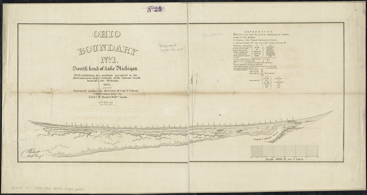
Shows narrow band of land along the southern coast of Lake Michigan near the Grand Calumic River; structures and vegetations, points of survey.
Includes references to the position occupied and notes.
From: Ohio and Michigan boundary ..., 1836. (Ex. Doc./HR 24th Congress, 1st Session, no. 54).
In lower left corner: [signed] A. Talcott, capt engr.
- Identifier:
-
06_01_011202
- Call #:
-
G4081.F7 1835 .H66
- Barcode:
-
30000004186497


