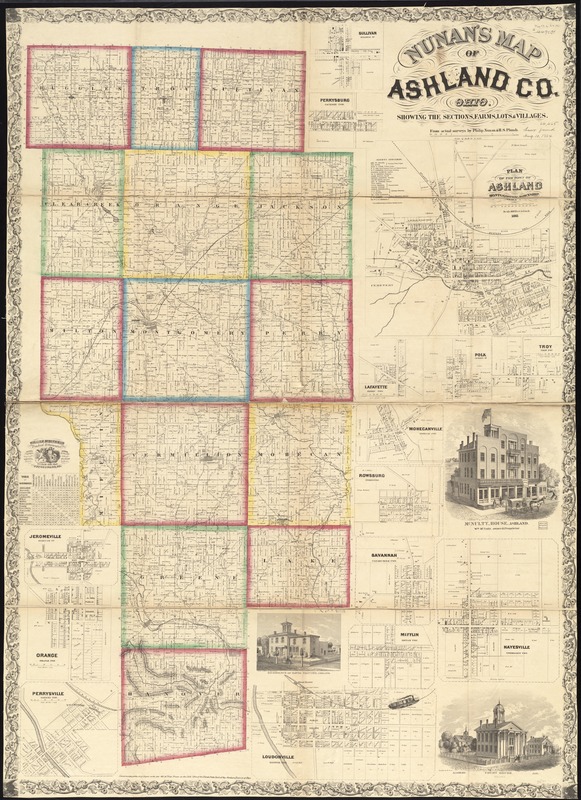
Nunan's map of Ashland Co., Ohio : showing the sections, farms, lots, & villages
Item Information
- Title:
- Nunan's map of Ashland Co., Ohio : showing the sections, farms, lots, & villages
- Creator:
- Nunan, Philip.
- Name on Item:
-
from actual surveys by Philip Nunan & H.S. Plumb ; William Schuchman, practical lithographer.
- Date:
-
[1861]
- Format:
-
Maps/Atlases
- Location:
-
Boston Public Library
Norman B. Leventhal Map Center - Collection (local):
-
Norman B. Leventhal Map Center Collection
- Subjects:
-
Buildings--Ohio--Ashland County--Pictorial works
Landowners--Ohio--Ashland County--Maps
Real property--Ohio--Ashland County--Maps
Ashland County (Ohio)--Maps
- Places:
-
Ashland (county)
- Extent:
- 1 map on 2 sheets : mounted on linen, color ; 146 x 107 cm, sheets 73 x 107 cm
- Terms of Use:
-
No known copyright restrictions.
No known restrictions on use.
- Publisher:
-
[Ohio] :
[publisher not identified]
- Scale:
-
Scale 1:42,240. 1 1/2 inch to a mile
- Language:
-
English
- Notes:
-
Relief shown by hachures.
Includes distance table, 15 insets and 3 views of public and residential properties
Insets: Sullivan, Sullivan Tp -- Perrysburg, Jackson Twp. -- Plan of the town of Ashland, Montgomery Township -- Lafayette, Perry Twp. -- Polk, Jackson Tp -- Troy, Troy Twp. -- Mohecanville, Mohecan Twp. -- Rowsburg, Perry Twp. -- Savannah, Clearcreek Twp. -- Hayesville, Vermillion Twp. -- Mifflin, Mifflin Twp. -- Loudonville, Hanover Twp. -- Jeromeville, Tp -- Orange, Orange Twp. -- Perrysville, Green Twp.
"Entered according to the Act of Congress in the year 1861, by Philip Nunan in the Clerks Office of the United States Court of the Northern District of Ohio."
BPL copy sectioned into 4 pieces and mounted on cloth.
- Notes (date):
-
This date is inferred.
- Identifier:
-
06_01_011308
- Call #:
-
G4083.A6 1861 .N86
- Barcode:
-
39999065683284
- LCCN:
-
2012592384


