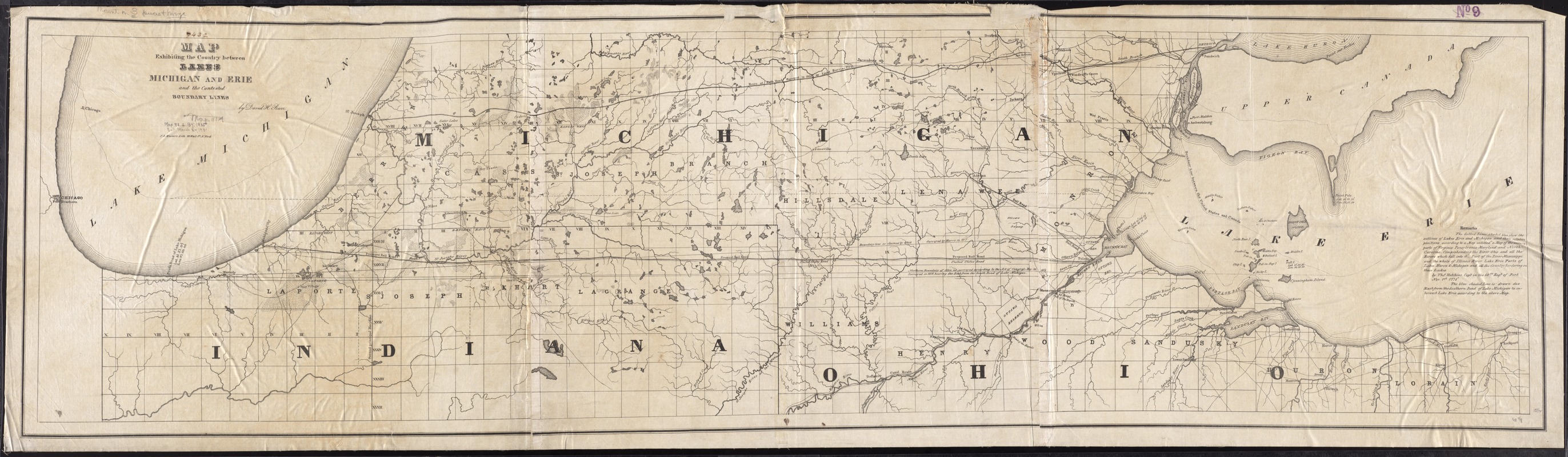
Map exhibiting the country between Lakes Michigan and Erie, and the contested boundary lines
Item Information
- Title:
- Map exhibiting the country between Lakes Michigan and Erie, and the contested boundary lines
- Creator:
- Burr, David H., 1803-1875
- Name on Item:
-
by David H. Burr.
- Date:
-
[1835?]
- Format:
-
Maps/Atlases
- Location:
-
Boston Public Library
Norman B. Leventhal Map Center - Collection (local):
-
Norman B. Leventhal Map Center Collection
- Subjects:
-
Toledo War, 1835--Maps
Michigan--Boundaries--Ohio--Maps
Ohio--Boundaries--Michigan--Maps
Michigan--Boundaries--Indiana--Maps
Indiana--Boundaries--Michigan--Maps
Great Lakes Region (North America)--Maps
- Places:
-
Ohio
Great Lakes Region (area)
Michigan
- Extent:
- 1 map on 3 sheets ; 41 x 158 cm.
- Terms of Use:
-
No known copyright restrictions.
No known restrictions on use.
- Publisher:
-
N[ew] York :
P.A. Mesier's Lith.
- Scale:
-
Scale [ca. 1:320,000]
- Language:
-
English
- Notes:
-
Includes remarks and notes.
Shows boundary disputes between Michigan, Indiana and Ohio dating from 1818.
BPL copy assembled.
- Identifier:
-
06_01_011325
- Call #:
-
G4111.F7 1835 .B87
- Barcode:
-
39999065683094


