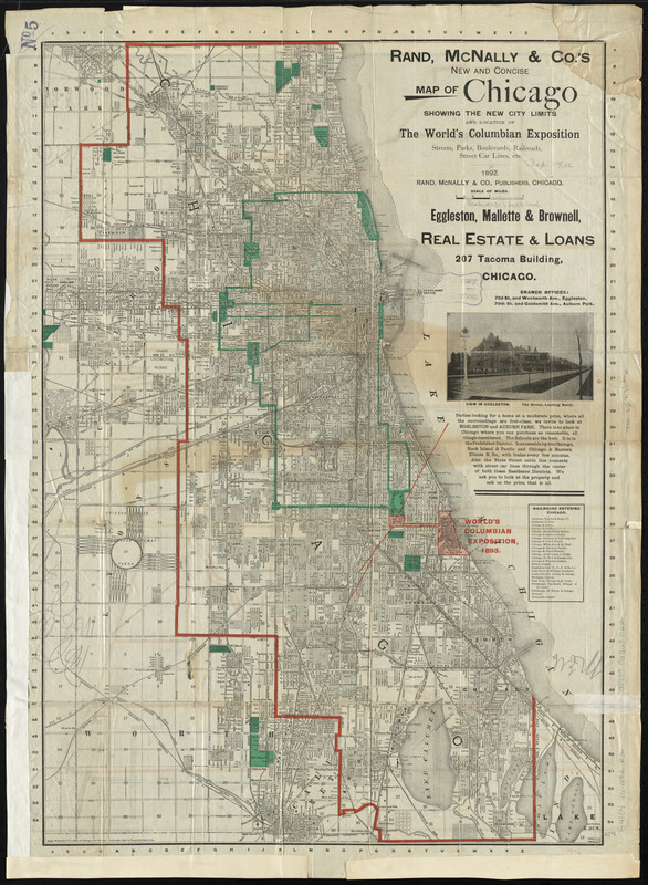
Rand, McNally & Co.'s new and concise map of Chicago : showing the city limits and location of the world's Columbian Exposition, streets, parks, boulevards, railroads, street car lines, etc.
Item Information
- Title:
- Rand, McNally & Co.'s new and concise map of Chicago : showing the city limits and location of the world's Columbian Exposition, streets, parks, boulevards, railroads, street car lines, etc.
- Cartographer:
- Rand McNally and Company
- Date:
-
1892
- Format:
-
Maps/Atlases
- Location:
-
Boston Public Library
Norman B. Leventhal Map Center - Collection (local):
-
Norman B. Leventhal Map Center Collection
- Subjects:
-
Chicago (Ill.)--Maps
- Places:
-
Cook (county)Chicago
- Extent:
- 1 map : color ; 69 x 48 cm
- Terms of Use:
-
No known copyright restrictions.
No known restrictions on use.
- Publisher:
-
Chicago :
Rand, McNally & Co.
- Scale:
-
Scale approximately 1:21,000
- Language:
-
English
- Notes:
-
Map of central Chicago on verso.
- Identifier:
-
06_01_011142
- Call #:
-
G4104.C6 1892 .R36
- Barcode:
-
39999065681122


