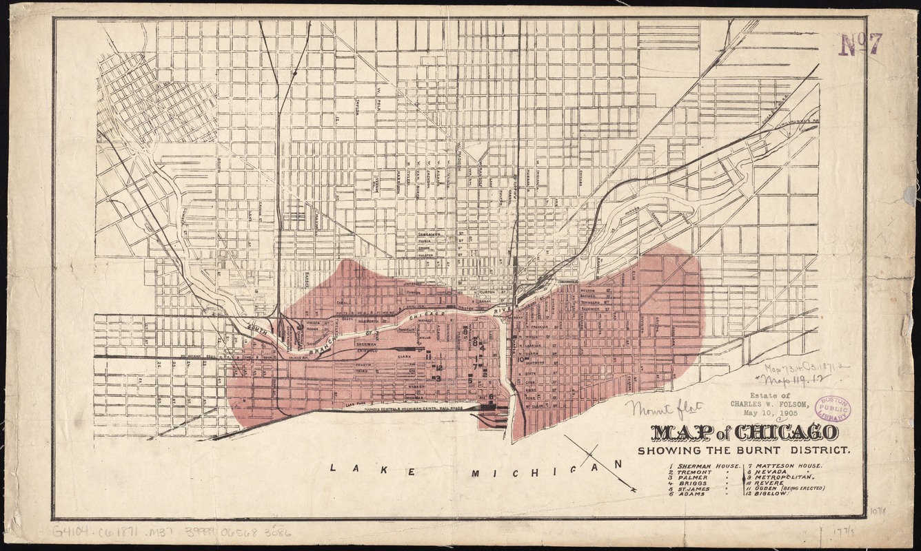
Map of Chicago showing the burnt district
Item Information
- Title:
- Map of Chicago showing the burnt district
- Date:
-
[ca. 1871]
- Format:
-
Maps/Atlases
- Location:
-
Boston Public Library
Norman B. Leventhal Map Center - Collection (local):
-
Norman B. Leventhal Map Center Collection
- Subjects:
-
Great Fire, Chicago, Ill., 1871--Maps
Chicago (Ill.)--Maps
- Places:
-
Cook (county)Chicago
- Extent:
- 1 map : col. ; 28 x 45 cm.
- Terms of Use:
-
No known copyright restrictions.
No known restrictions on use.
- Publisher:
-
S.l :
s.n.
- Scale:
-
Scale [ca. 1:24,000]
- Language:
-
English
- Notes:
-
Shows extent of fire.
Oriented with north to the lower right.
Includes key to points of interest.
- Identifier:
-
06_01_011324
- Call #:
-
G4104.C6 1871 .M37
- Barcode:
-
39999065683086