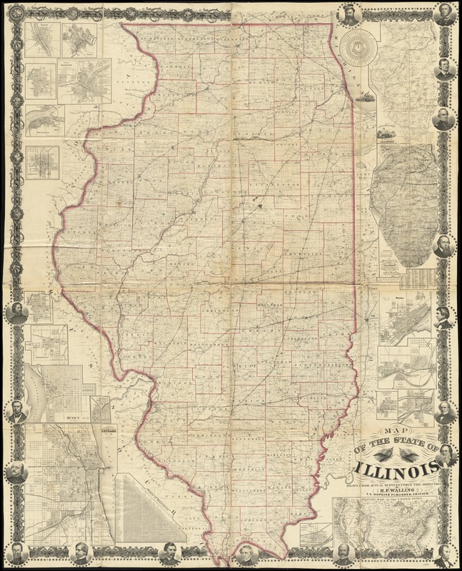
Map of the state of Illinois
Item Information
- Title:
- Map of the state of Illinois
- Creator:
- Walling, Henry Francis, 1825-1888
- Name on Item:
-
drawn from actual surveys under the direction of H.F. Walling.
- Date:
-
[1863?]
- Format:
-
Maps/Atlases
- Location:
-
Boston Public Library
Norman B. Leventhal Map Center - Collection (local):
-
Norman B. Leventhal Map Center Collection
- Subjects:
-
Geology--Illinois--Maps
Climatology--Maps
Illinois--Maps
- Places:
-
Illinois
- Extent:
- 1 map on 4 sheets : col., assembled ; 181 x 133 cm.
- Terms of Use:
-
No known copyright restrictions.
No known restrictions on use.
- Publisher:
-
Chicago :
T.E. Hopkins
- Scale:
-
Scale [ca. 1:360,000]
- Language:
-
English
- Notes:
-
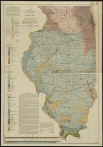
Includes time dial, distance chart, population table, ill., and 19 insets.
Ill. of political figures in ornamental border.
Climatological map dated 1863.
Insets: Geological map of the state of Illinois -- Climatological map of the state of Illinois shewing the isothermal lines, comparative amount of rainfall &c. / by Lorin Blodget -- Peoria -- City of La Salle, La Salle Co. ; City of Peru, La Salle Co. -- Litchfield, Montgomery Co. -- City of Ottawa -- Military map of the United States -- City of Morris, Grundy Co. -- Elgin -- Galena -- City of Bloomington, McLean Co. -- City of Rockford -- Rock Island -- Springfield -- City of Bloomington, McLean Co. -- Jacksonville -- Quincy, Adams Co. -- City of Mendota -- City of Chicago.
- Identifier:
-
06_01_011092
- Call #:
-
G4100 1863 .W35
- Barcode:
-
39999065681445

![[Illinois]](https://bpldcassets.blob.core.windows.net/derivatives/images/commonwealth:4m90f716w/image_thumbnail_300.jpg)

