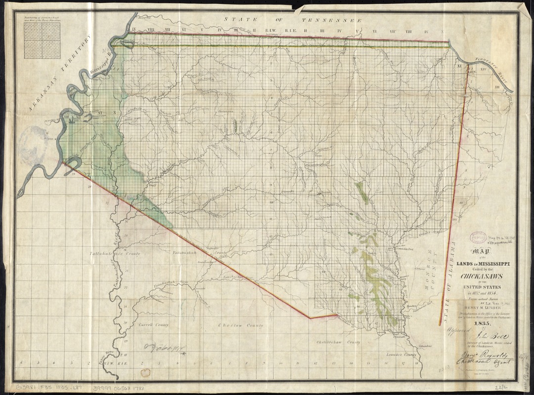
Map of the lands in Mississippi ceded by the Chickasaws to the United States in 1832 and 1834
Item Information
- Title:
- Map of the lands in Mississippi ceded by the Chickasaws to the United States in 1832 and 1834
- Creator:
- Lusher, Henry M.
- Name on Item:
-
from actual survey by Henry M. Lusher, draughtsman in the Office of the Surveyor Genl. of lands in Missis: ceded by the Chickasaws ; Eddy del. on stone.
- Date:
-
1835
- Format:
-
Maps/Atlases
- Location:
-
Boston Public Library
Norman B. Leventhal Map Center - Collection (local):
-
Norman B. Leventhal Map Center Collection
- Subjects:
-
Indian land transfers--Mississippi--Maps
Indians of North America--Mississippi--Maps
Chickasaw Indians--Land tenure--Maps
Mississippi--Maps
- Places:
-
Mississippi
- Extent:
- 1 map col. 44 x 55 cm.
- Terms of Use:
-
No known copyright restrictions.
No known restrictions on use.
- Publisher:
-
United States :
[Office of the Surveyor General]
- Scale:
-
Scale [ca. 1:460,000]
- Language:
-
English
- Notes:
-
Numbering of sections east and lands in Mississippi ceded by the Chickasaws to the United States in 1832 and 1834.
Approved, John Bell, Surveyor of Lands in Missis: ceded by the Chickasaws. Benja. Reynold, Chickasaw agent."
- Identifier:
-
06_01_011057
- Call #:
-
G3981.F35 1835 .L87
- Barcode:
-
39999065681783


