Map of Whitley County
Item Information
- Title:
- Map of Whitley County
- Title (alt.):
-
Report on the geology of Whitley County and a part of Pulaski
- Creator:
- Hoeing, J. B. (Joseph Bernard), 1855-
- Name on Item:
-
by J.B Hoeing, topographer ; geology by A.R. Crandall.
- Date:
-
1889
- Format:
-
Maps/Atlases
- Location:
-
Boston Public Library
Norman B. Leventhal Map Center - Collection (local):
-
Norman B. Leventhal Map Center Collection
- Subjects:
-
Geology--Kentucky--Whitley County--Maps
Geology--Kentucky--McCreary County--Maps
Whitley County (Ky.)--Maps
McCreary County (Ky.)--Maps
- Places:
-
Whitley (county)
McCreary (county)
- Extent:
- 1 map : col. ; 45 x 57 cm.
- Terms of Use:
-
No known copyright restrictions.
No known restrictions on use.
- Publisher:
-
[Frankfort, Ky.] :
Geological Survey of Kentucky
- Scale:
-
Scale [1:126,720]. 2 miles = 1 in.
- Language:
-
English
- Notes:
-
To accompany: Report on the geology of Whitley County and a part of Pulaski, with map and illustrations / A.R. Crandall. Frankfort, Ky.: Geological Survey of Kentucky, [1889]. (Miscellaneous geological reports (Kentucky Geological Survey) ; ser. 2, v. 11).
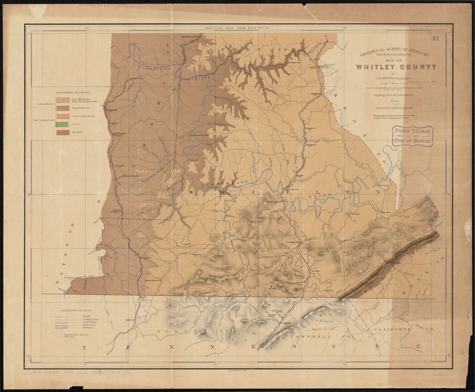
An early state of Hoeing's 1889 map. This state correctly names Hoeing as J.B., not "J.R.," and displays the "Convention of Colors" at the upper left.
Includes area west of the Cumberland River to the Cincinnati Southern Railroad and labeled as Pulaski County which is included in present-day McCreary County.
Relief shown by shading and spot heights.
"Julius Bien & Co., Lith."
"Topography is taken principally from the maps of the U.S. Geological Survey."
- Identifier:
-
06_01_011046
- Call #:
-
G3953.W6C5 1889 .H64
- Barcode:
-
39999065681866


