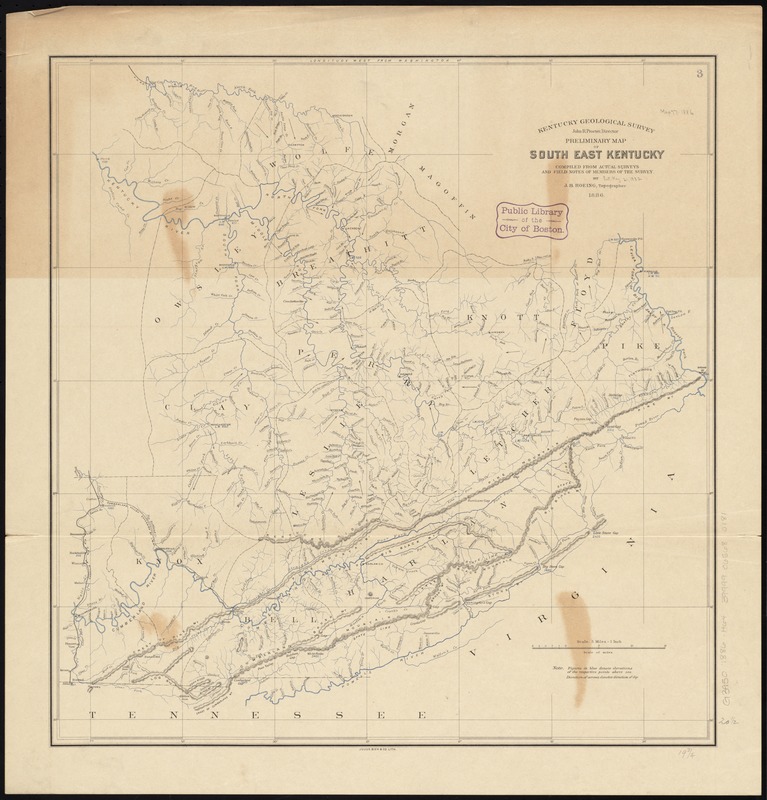
Preliminary map of south east Kentucky
Item Information
- Title:
- Preliminary map of south east Kentucky
- Creator:
- Hoeing, J. B. (Joseph Bernard), 1855-
- Name on Item:
-
compiled from actual surveys and field notes of members of the Survey by J.B. Hoeing, topographer.
- Date:
-
1886
- Format:
-
Maps/Atlases
- Location:
-
Boston Public Library
Norman B. Leventhal Map Center - Collection (local):
-
Norman B. Leventhal Map Center Collection
- Subjects:
-
Kentucky--Maps
- Places:
-
Kentucky
- Extent:
- 1 map : col. ; 53 x 51 cm.
- Terms of Use:
-
No known copyright restrictions.
No known restrictions on use.
- Publisher:
-
[Frankfort, Ky.] :
Kentucky Geological Survey
- Scale:
-
Scale [1:316,800]. 5 miles = 1 in.
- Language:
-
English
- Notes:
-
Relief shown by hachures and spot heights.
Prime meridian: Washington.
- Identifier:
-
06_01_011028
- Call #:
-
G3950 1886 .H64
- Barcode:
-
39999065680181


