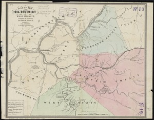
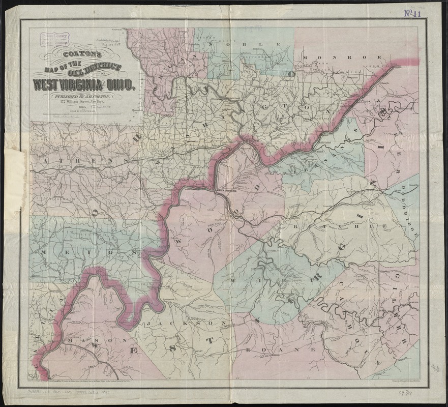
Colton's map of the oil district of West Virginia and Ohio
Item Information
- Title:
- Colton's map of the oil district of West Virginia and Ohio
- Creator:
- Colton, J. H. (Joseph Hutchins), 1800-1893
- Date:
-
1865
- Format:
-
Maps/Atlases
- Location:
-
Boston Public Library
Norman B. Leventhal Map Center - Collection (local):
-
Norman B. Leventhal Map Center Collection
- Subjects:
-
Gas wells--Ohio--Maps
Gas wells--West Virginia--Maps
Oil fields--Ohio--Maps
Oil fields--West Virginia--Maps
Ohio--Maps
West Virginia--Maps
- Places:
-
Ohio
West Virginia
- Extent:
- 1 map : col. ; 69 x 76 cm.
- Terms of Use:
-
No known copyright restrictions.
No known restrictions on use.
- Publisher:
-
New York :
J.H. Colton
- Scale:
-
Scale [ca. 1:160,000]
- Language:
-
English
- Notes:
-
Covers northwestern West Virginia and southeastern Ohio, showing oil wells and gas springs.
Prime meridian: Washington D.C.
- Identifier:
-
06_01_011016
- Call #:
-
G3891.H8 1865 .C65
- Barcode:
-
39999065680397