Map of the oil district of West Virginia
Item Information
- Title:
- Map of the oil district of West Virginia
- Description:
-
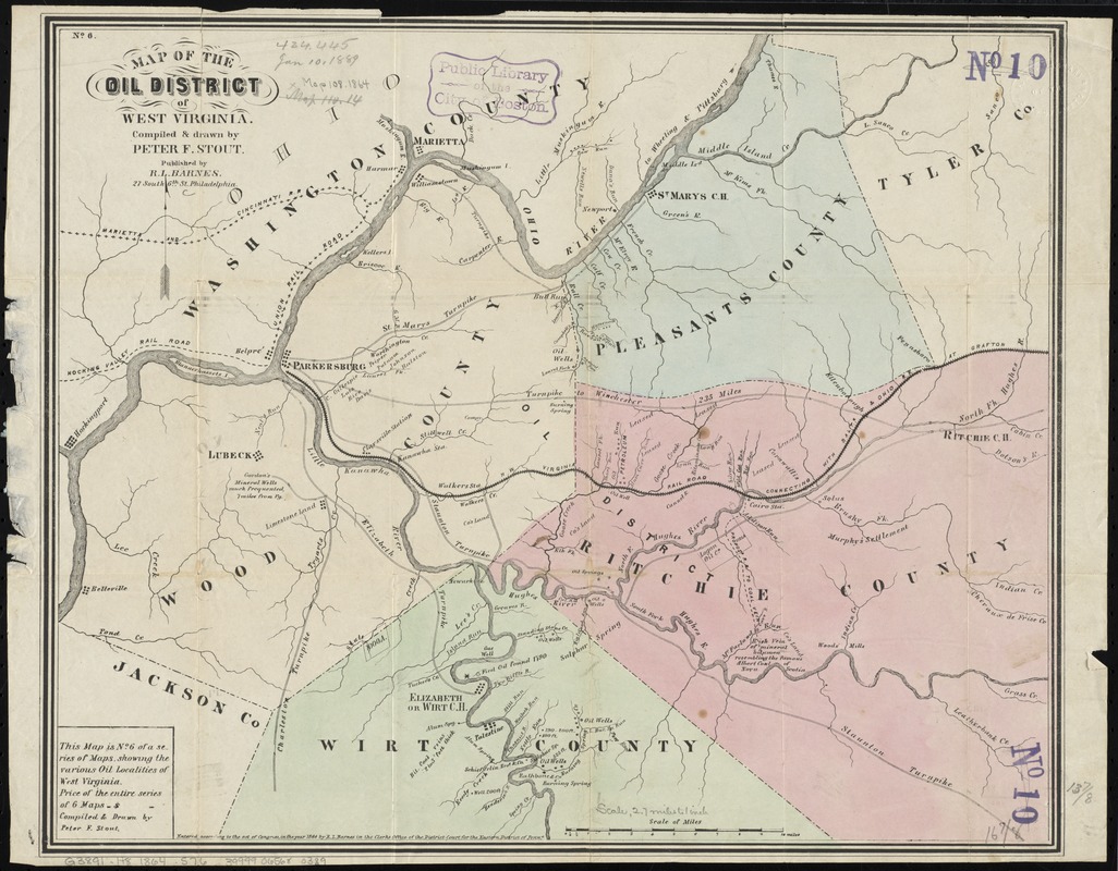
Although West Virginia is the second state in the country for coal production, crude oil has also been drilled for since the mid-19th century. This map, produced during the Civil War, shows the "oil district" of West Virginia, and includes locations of oil and gas wells, as well as coal seams. The map has a note stating "first oil found 1790," in a location just north of present-day Elizabeth in Wirt County.
- Creator:
- Stout, Peter F.
- Name on Item:
-
compiled & drawn by Peter F. Stout.
- Date:
-
1864
- Format:
-
Maps/Atlases
- Location:
-
Boston Public Library
Norman B. Leventhal Map Center - Collection (local):
-
Norman B. Leventhal Map Center Collection
- Subjects:
-
Oil fields--West Virginia--Maps
West Virginia--Maps
- Places:
-
West Virginia
- Extent:
- 1 map : hand col. ; 36 x 44 cm.
- Terms of Use:
-
No known copyright restrictions.
No known restrictions on use.
- Publisher:
-
Philadelphia :
R.L. Barnes
- Scale:
-
Scale [ca. 1:170,000]
- Language:
-
English
- Notes:
-
Covers Wood, Pleasants, Ritchie, and Wirt counties.
In upper left: No. 6.
"This map is no. 6 of a series of maps, showing the various oil localities of West Virginia."
"Entered according to the act of Congress, in the year 1864 by R.L. Barnes in the Clerks Office of the District Court for the Eastern District of Penna."
- Notes (exhibitions):
-
Exhibited: "Beneath Our Feet: Mapping the World Below" organized by the Norman B. Leventhal Map Center at the Boston Public Library, 2017-2018.
- Identifier:
-
06_01_011015
- Call #:
-
G3891.H8 1864 .S76
- Barcode:
-
39999065680389


