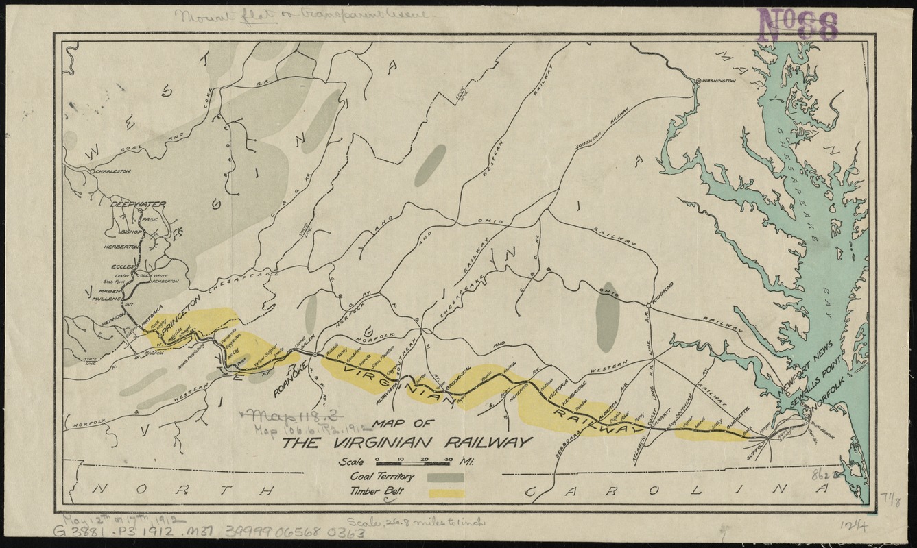
Map of the Virginian Railway
Item Information
- Title:
- Map of the Virginian Railway
- Date:
-
[1912?]
- Format:
-
Maps/Atlases
- Location:
-
Boston Public Library
Norman B. Leventhal Map Center - Collection (local):
-
Norman B. Leventhal Map Center Collection
- Subjects:
-
Coal mines and mining--West Virginia--Maps
Coal mines and mining--Virginia--Maps
Forests and forestry--Virginia--Maps
Forests and forestry--West Virginia--Maps
Railroads--Virginia--Maps
Railroads--West Virginia--Maps
Virginia--Maps
West Virginia--Maps
- Places:
-
Virginia
West Virginia
- Extent:
- 1 map : col. ; 18 x 32 cm.
- Terms of Use:
-
No known copyright restrictions.
No known restrictions on use.
- Publisher:
-
S.l :
s.n.
- Scale:
-
Scale [ca. 1:680,000]
- Language:
-
English
- Notes:
-
Shows the Virginian Railway from Princeton, W.V. to Suffolk, Va. Also shows coal territory and timber belt.
Text on verso: Report of I.C. White, State Geologist of West Virginia, April 3, 1912 -- Extracts from report of W.H. Coverdale, consulting engineer, New York.
- Identifier:
-
06_01_011012
- Call #:
-
G3881.P3 1912 .M37
- Barcode:
-
39999065680363