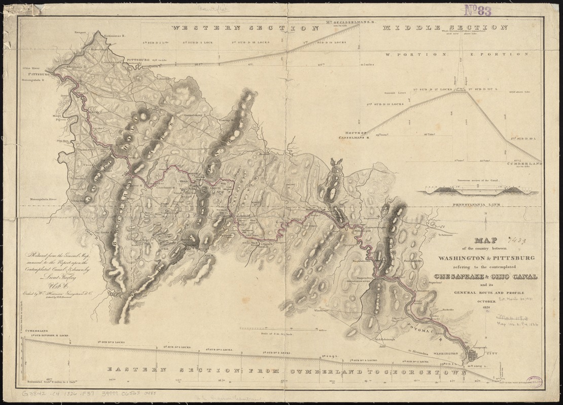
Map of the country between Washington & Pittsburg refering to the contemplated Chesapeake & Ohio Canal and its general route and profile, October 1826
Item Information
- Title:
- Map of the country between Washington & Pittsburg refering to the contemplated Chesapeake & Ohio Canal and its general route and profile, October 1826
- Creator:
- Farley, John, 1802 or 1803-1874
- Name on Item:
-
reduced from the general map annexed to the report upon the comtemplated canal & drawn by Lieut Farley ; etched by Wm. Harrison ; lettered by D.R. Harrison.
- Date:
-
[1826]
- Format:
-
Maps/Atlases
- Location:
-
Boston Public Library
Norman B. Leventhal Map Center - Collection (local):
-
Norman B. Leventhal Map Center Collection
- Subjects:
-
Canals--Maryland--Maps
Canals--Pennsylvania--Maps
Chesapeake and Ohio Canal (Md. and Washington, D.C.)--Maps
- Places:
-
Chesapeake and Ohio Canal
- Extent:
- 1 map : hand colored ; 45 x 65 cm
- Terms of Use:
-
No known copyright restrictions.
No known restrictions on use.
- Publisher:
-
[United States] :
[publisher not identified]
- Scale:
-
Scale [1:506,880]. 8 m. to 1 inch
- Language:
-
English
- Notes:
-
Relief shown by hachures.
Includes profile diagram in 3 sections and transverse section diagram.
- Notes (date):
-
This date is inferred.
- Identifier:
-
06_01_010987
- Call #:
-
G3842.C4 1826 .F37
- Barcode:
-
39999065680488


