Map of North Carolina
Item Information
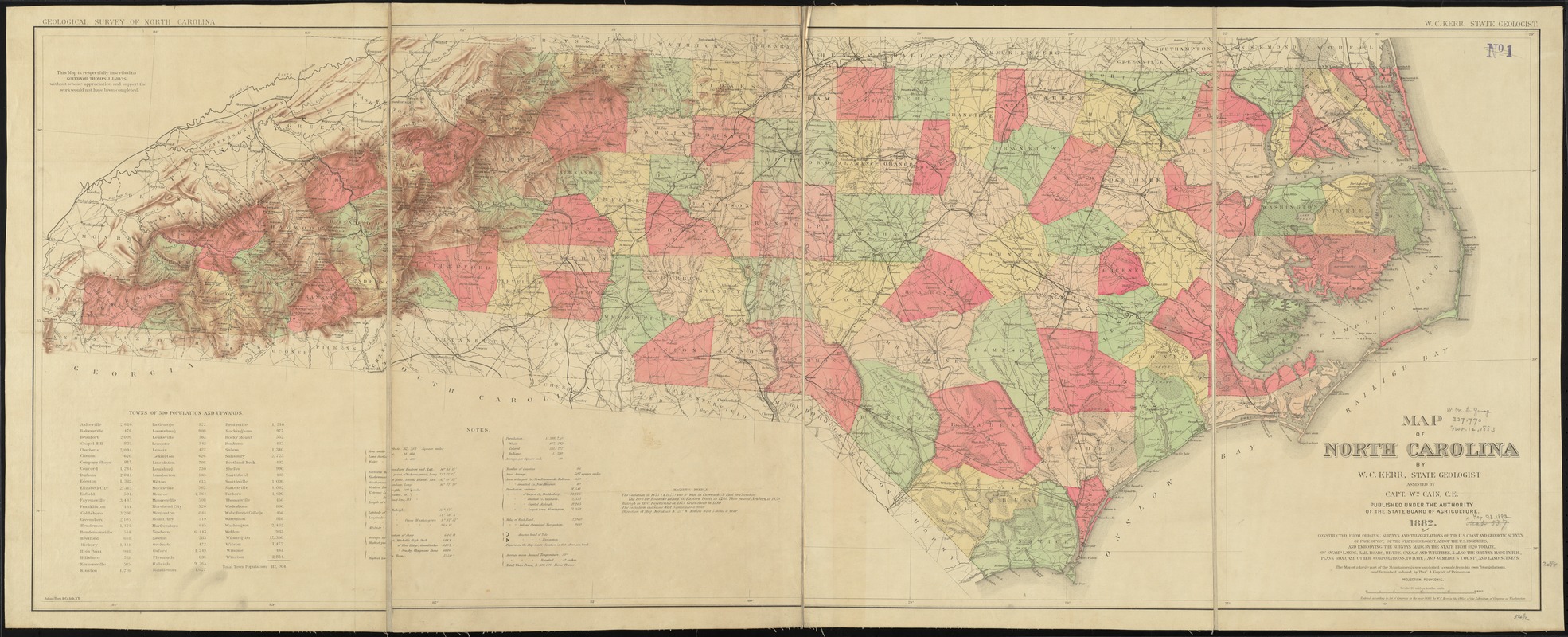
- Title:
- Map of North Carolina
- Creator:
- Kerr, Washington Caruthers, 1827-1885
- Name on Item:
-
by W.C. Kerr ; assisted by Wm. Cain.
- Date:
-
1882
- Format:
-
Maps/Atlases
- Location:
-
Boston Public Library
Norman B. Leventhal Map Center - Collection (local):
-
Norman B. Leventhal Map Center Collection
- Subjects:
-
North Carolina--Maps
- Places:
-
North Carolina
- Extent:
- 1 map : hand col. ; 63 x 139 cm.
- Terms of Use:
-
No known copyright restrictions.
No known restrictions on use.
- Publisher:
-
Raleigh, N.C :
[Geological Survey of North Carolina]
- Scale:
-
Scale [1:633,600]. 10 miles to the inch ;
- Language:
-
English
- Notes:
-
Relief shown by shading and spot heights.
"Constructed from original surveys and triangulations of the U.S. Coast and Geodetic Survey, of Prof. Guyot, of the state geologist, and of the U.S. engineers; and embodying the surveys made by the state from 1820 to date, of swamp lands, rail roads, rivers, canals and turnpikes; & also the surveys made by R.R., plank road, and other corporations, to date; and numerous county and land surveys."
"The map of a large part of the mountain region was plotted to scale, from his own triangulations, and furnished by hand, by Prof. A. Guyot of Princeton."
"Published under the authority of the State Board of Agriculture."
Includes population chart, statistics, and cartographic note.
"Entered according to Act of Congress in the year 1882, by W.C. Kerr ..."
- Identifier:
-
06_01_010969
- Call #:
-
G3900 1882 .K47
- Barcode:
-
39999065680876


