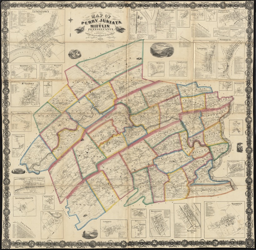
Map of the counties of Perry, Juniata and Mifflin, Pennsylvania
Item Information
- Title:
- Map of the counties of Perry, Juniata and Mifflin, Pennsylvania
- Creator:
- Hopkins, Griffith Morgan, Jr
- Name on Item:
-
from actual surveys by and under the direction of G.M. Hopkins, C.E. ; eng'd by Worley & Bracher.
- Date:
-
1863
- Format:
-
Maps/Atlases
- Location:
-
Boston Public Library
Norman B. Leventhal Map Center - Collection (local):
-
Norman B. Leventhal Map Center Collection
- Subjects:
-
Real property--Pennsylvania--Perry County--Maps
Landowners--Pennsylvania--Perry County--Maps
Real property--Pennsylvania--Juniata County--Maps
Landowners--Pennsylvania--Juniata County--Maps
Real property--Pennsylvania--Mifflin County--Maps
Landowners--Pennsylvania--Mifflin County--Maps
Perry County (Pa.)--Maps
Juniata County (Pa.)--Maps
Mifflin County (Pa.)--Maps
- Places:
-
Juniata (county)
Mifflin (county)
Perry (county)
- Extent:
- 1 map : hand col. ; 143 x 143 cm.
- Terms of Use:
-
No known copyright restrictions.
No known restrictions on use.
- Publisher:
-
Philadelphia :
Smith, Gallup & Hewitt
- Scale:
-
Scale [1:63,360]. 1 inch to the mile
- Language:
-
English
- Notes:
-
Relief shown by hachures.
Includes 3 tables of distances, 5 ill., and 33 insets, some with business directories.
Also shows land owners.
- Identifier:
-
06_01_010913
- Call #:
-
G3823.P3 1863 .H67
- Barcode:
-
39999065679522


