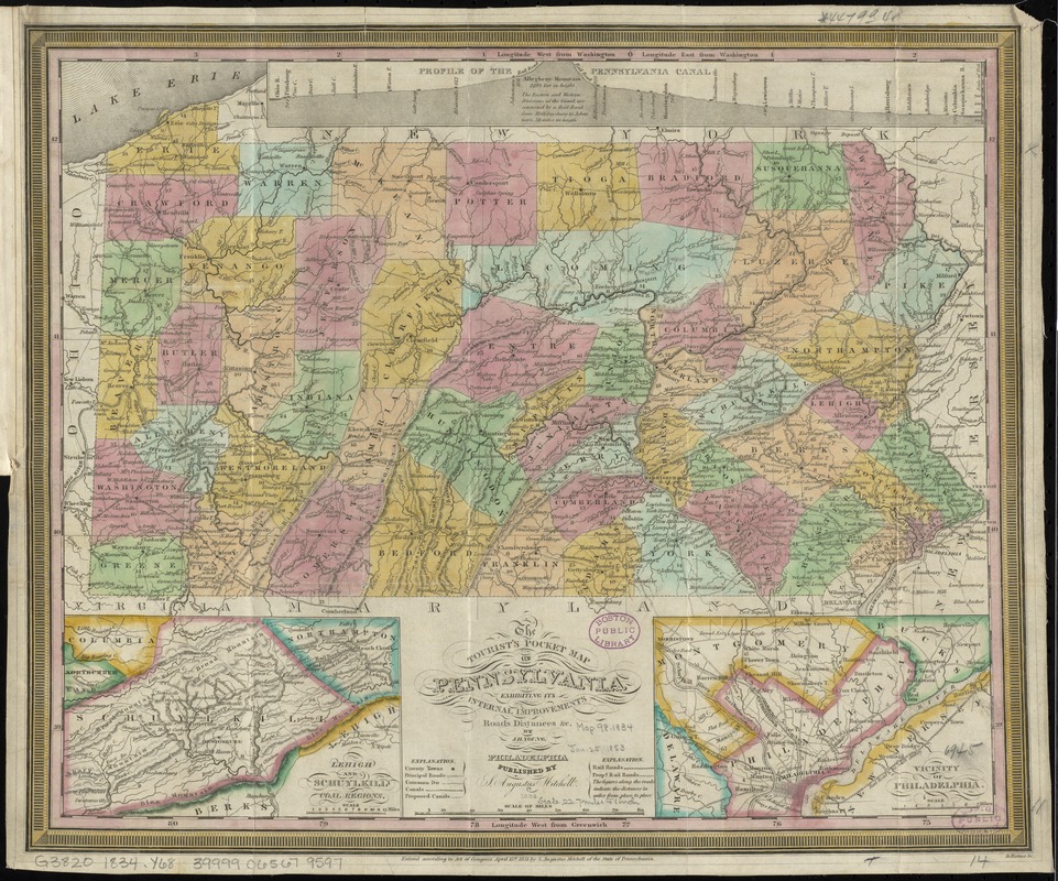
The tourist's pocket map of Pennsylvania : exhibiting its internal improvements, roads, distances, &c
Item Information
- Title:
- The tourist's pocket map of Pennsylvania : exhibiting its internal improvements, roads, distances, &c
- Creator:
- Young, J. H. (James Hamilton)
- Name on Item:
-
by J.H. Young ; D. Haines sc.
- Date:
-
1834
- Format:
-
Maps/Atlases
- Location:
-
Boston Public Library
Norman B. Leventhal Map Center - Collection (local):
-
Norman B. Leventhal Map Center Collection
- Subjects:
-
Pennsylvania--Maps
- Places:
-
Pennsylvania
- Extent:
- 1 map : hand col. ; 31 x 37 cm.
- Terms of Use:
-
No known copyright restrictions.
No known restrictions on use.
- Publisher:
-
Philadelphia :
S. Augustus Mitchell
- Scale:
-
Scale [ca. 1:1,430,000]
- Language:
-
English
- Notes:
-
Cover title: Mitchell's map of Pennsylvania.
Prime meridians: Washington and Greenwich.
Insets: Lehigh and Schuylkill coal regions -- Vicinity of Philadelphia.
Includes Profile of the Pennsylvania Canal.
"Pennsylvania census, 1830" inside front cover.
Boston Public Library copy lacking covers.
"Entered according to Act of Congress, April 15th, 1831 by S. Augustus Mitchell of the State of Pennsylvania.
- Identifier:
-
06_01_010917
- Call #:
-
G3820 1834 .Y68
- Barcode:
-
39999065679597


