Pennsylvania
Item Information
- Title:
- Pennsylvania
- Description:
-
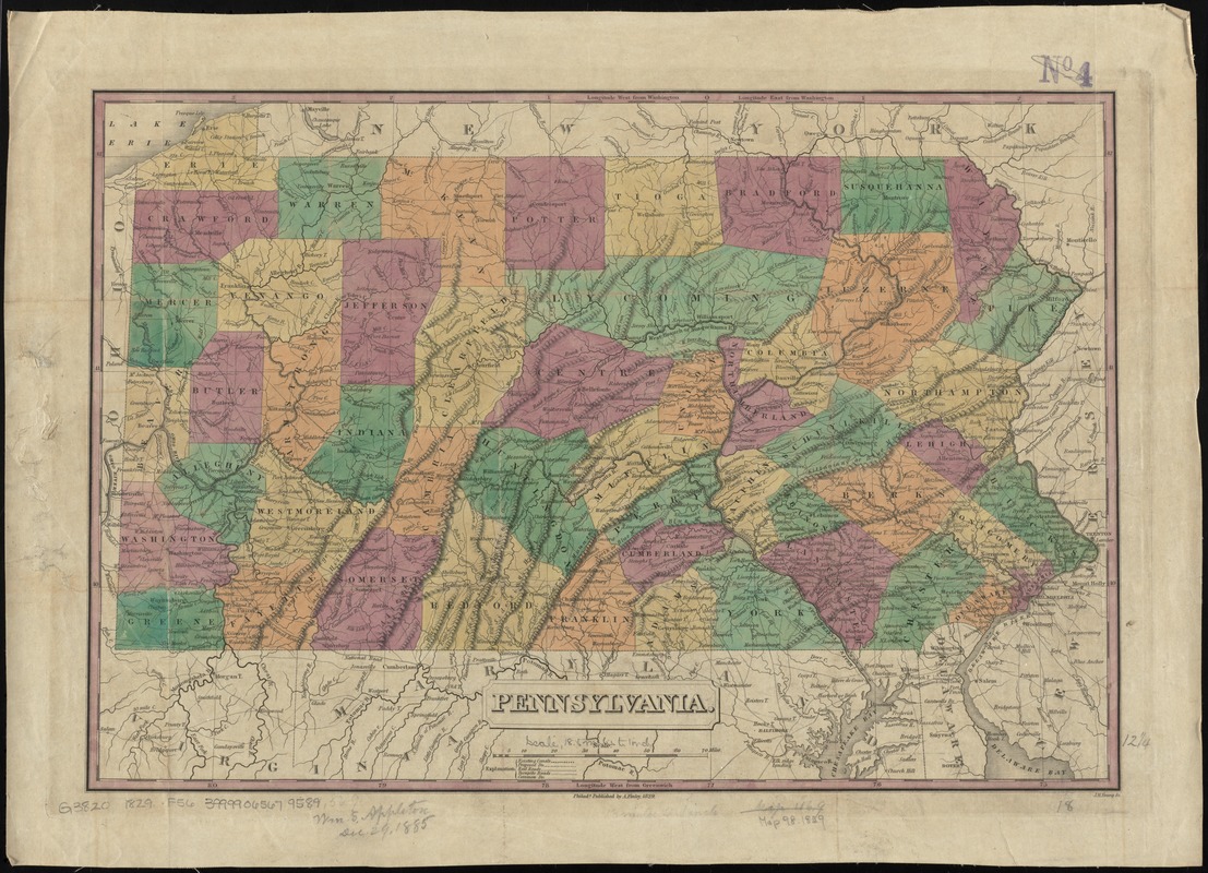
Shows roads, canals, railroads, and proposed railroads. Counties are distinguished by color. Earliest general map of the state to show railroads.
- Creator:
- Finley, A. (Anthony)
- Name on Item:
-
J.H. Young sc.
- Date:
-
1829
- Format:
-
Maps/Atlases
- Location:
-
Boston Public Library
Norman B. Leventhal Map Center - Collection (local):
-
Norman B. Leventhal Map Center Collection
- Subjects:
-
Pennsylvania--Maps
- Places:
-
Pennsylvania
- Extent:
- 1 map : hand col. ; 32 x 47 cm.
- Terms of Use:
-
No known copyright restrictions.
No known restrictions on use.
- Publisher:
-
Philada :
A. Finley
- Scale:
-
Scale [ca. 1:1,130,000]
- Language:
-
English
- Notes:
-
Relief shown pictorially.
Prime meridians: Washington and Greenwich.
- Identifier:
-
06_01_010916
- Call #:
-
G3820 1829 .F56
- Barcode:
-
39999065679589
- LCCN:
-
98688548


