Map of Warren County, New Jersey
Item Information
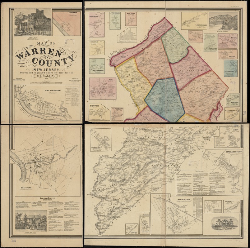
- Title:
- Map of Warren County, New Jersey
- Creator:
- Walling, Henry Francis, 1825-1888
- Name on Item:
-
drawn and engraved under the direction of H.F. Walling ; field work by G.M. Hopkins, Jr.
- Date:
-
1860
- Format:
-
Maps/Atlases
- Location:
-
Boston Public Library
Norman B. Leventhal Map Center - Collection (local):
-
Norman B. Leventhal Map Center Collection
- Subjects:
-
Real property--New Jersey--Warren County--Maps
Landowners--New Jersey--Warren County--Maps
Warren County (N.J.)--Maps
- Places:
-
Warren (county)
- Extent:
- 1 map on 4 sheets : col. ; 133 x 136 cm., sheets 75 x 99 cm. or smaller.
- Terms of Use:
-
No known copyright restrictions.
No known restrictions on use.
- Publisher:
-
New York :
Smith, Gallup & Co.
- Scale:
-
Scale 1:42,240. 1 1/2 inch to a mile
- Language:
-
English
- Notes:
-
Relief shown by hachures.
Upper half of map colored.
Includes names of property owners.
Includes 27 insets, 4 ill., distance chart, and business directories.
- Identifier:
-
06_01_010903
- Call #:
-
G3813.W3 1860 .W35
- Barcode:
-
39999065679407


