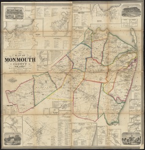
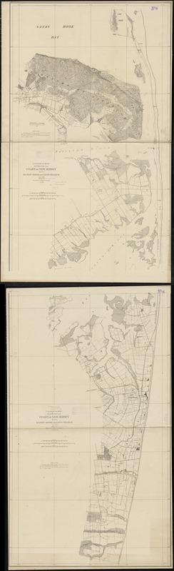
Coast of New Jersey between Sandy Hook and Long Branch
Item Information
- Title:
- Coast of New Jersey between Sandy Hook and Long Branch
- Creator:
- United States Coast Survey
- Name on Item:
-
U.S. Coast Survey ; surveyed by C.M. Bache.
- Date:
-
[1867?]
- Format:
-
Maps/Atlases
- Location:
-
Boston Public Library
Norman B. Leventhal Map Center - Collection (local):
-
Norman B. Leventhal Map Center Collection
- Subjects:
-
Coasts--New Jersey--Monmouth County--Maps
Monmouth County (N.J.)--Maps
Long Branch (N.J.)--Maps
Sandy Hook (N.J.)--Maps
- Places:
-
Monmouth (county)Sandy Hook (cape)
Monmouth (county)Long Branch
- Extent:
- 1 map on 2 sheets ; 210 x 64 cm., sheets 110 x 68 cm.
- Terms of Use:
-
No known copyright restrictions.
No known restrictions on use.
- Publisher:
-
[Washington, D.C.] :
The Survey
- Scale:
-
Scale 1:10,000
- Language:
-
English
- Table of Contents:
-
Sheet I : Surveyed by C.M. Bache, assistant, in 1864; Highlands of Navesink surveyed by A.M. Harrison in 1855
Sheet II : Surveyed by C.M. Bache, assistant in 1865 & 1866.
- Notes:
-
Highlands of Navesink surveyed by A.M. Harrison ... 1855--Sheet II.
Relief shown by contours. Depths shown by isolines.
Sheet I "surveyed in 1864", sheet II "surveyed in "1865 & 66."
- Identifier:
-
06_01_010896
- Call #:
-
G3813.M6C6 1867 .U55
- Barcode:
-
39999065679738