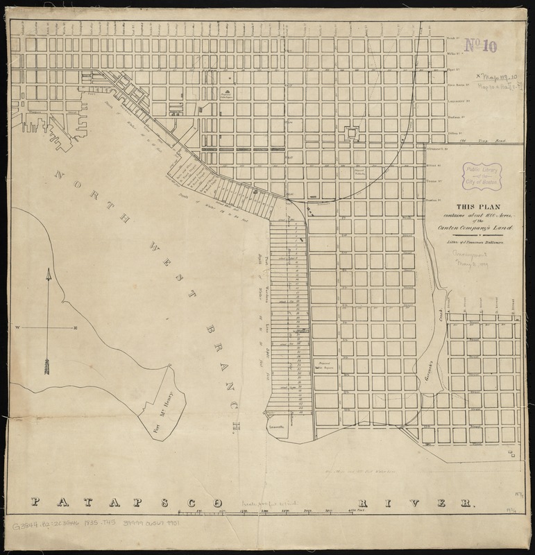
This plan contains about 1000 acres, of the Canton Company's Land
Item Information
- Title:
- This plan contains about 1000 acres, of the Canton Company's Land
- Lithographer:
- Penniman, John, approximately 1817-1850
- Name on Item:
-
litho. of J. Penniman.
- Date:
-
[1835]
- Format:
-
Maps/Atlases
- Location:
-
Boston Public Library
Norman B. Leventhal Map Center - Collection (local):
-
Norman B. Leventhal Map Center Collection
- Subjects:
-
Railroads--Maryland--Baltimore--Maps
Real property--Maryland--Baltimore--Maps
Canton (Baltimore, Md.)--Maps
- Places:
-
Baltimore Independent City (county)Baltimore
Baltimore Independent City (county)Canton
- Extent:
- 1 map ; 49 x 51 cm.
- Terms of Use:
-
No known copyright restrictions.
No known restrictions on use.
- Publisher:
-
S.l :
s.n.
- Scale:
-
Scale [ca. 1:7,200]
- Language:
-
English
- Notes:
-
Shows the Canton and Canton Industrial Area of Baltimore.
From Report on the objects, condition and prospects of the Canton Company of Baltimore.
- Notes (date):
-
This date is inferred.
- Identifier:
-
06_01_010865
- Call #:
-
G3844.B2:2C3G46 1835 .T45
- Barcode:
-
39999065679951


