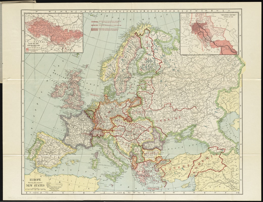
Europe showing the proposed new states
Item Information
- Title:
- Europe showing the proposed new states
- Title (alt.):
-
Hammond's map of Europe
Hammond's map of old and new Europe showing peace conference boundaries
- Creator:
- C.S. Hammond & Company
- Date:
-
[1919]
- Format:
-
Maps/Atlases
- Location:
-
Boston Public Library
Norman B. Leventhal Map Center - Collection (local):
-
Norman B. Leventhal Map Center Collection
- Subjects:
-
World War, 1914-1918--Aftermath--Maps
Europe--Boundaries--Maps
Europe--Administrative and political divisions--Maps
- Places:
-
Europe
Europe
- Extent:
- 1 map : col. ; 48 x 61 cm., folded in cover 22 x 11 cm.
- Terms of Use:
-
No known copyright restrictions.
No known restrictions on use.
- Publisher:
-
New York :
C.S. Hammond & Co.
- Scale:
-
Scale [ca. 1:9,000,000]
- Language:
-
English
- Notes:
-
Shows boundaries ca. 1919 after World War I. Shows boundaries established by the Treaty of Versailles and proposed in the Paris peace conference.
Insets: Land of the Czecho-slovaks -- "Kultur's empire" spring of 1918.
- Notes (date):
-
This date is inferred.
- Identifier:
-
06_01_010848
- Call #:
-
G5701.F7 1919 .C74
- Barcode:
-
39999065678169


