Topographical map of the City and County of New-York, and the adjacent country : with views in the border of the principal buildings, and interesting scenery of the island
Item Information
- Title:
- Topographical map of the City and County of New-York, and the adjacent country : with views in the border of the principal buildings, and interesting scenery of the island
- Creator:
- J.H. Colton & Co
- Date:
-
1836
- Format:
-
Maps/Atlases
- Location:
-
Boston Public Library
Norman B. Leventhal Map Center - Collection (local):
-
Norman B. Leventhal Map Center Collection
- Subjects:
-
New York (N.Y.)--Maps
Manhattan (New York, N.Y.)--Maps
New York Metropolitan Area--Maps
Manhattan (New York, N.Y.)--Pictorial works
- Places:
-
New YorkManhattan
- Extent:
- 1 map ; 60 x 155 cm.
- Terms of Use:
-
No known copyright restrictions.
No known restrictions on use.
- Publisher:
-
New-York :
J.H. Colton & Co.
- Scale:
-
Scale [ca. 1:16,000]
- Language:
-
English
- Notes:
-
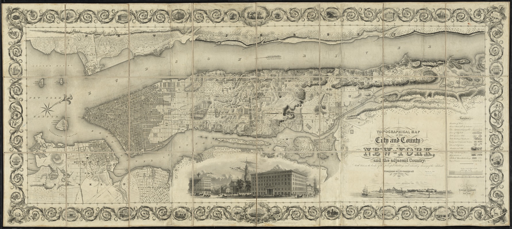
Oriented with north towards the upper right.
Relief shown by hachures.
Shows wards, physical features, public buildings, and various places of interest.
First state, without Madison Square.
Illustrations: Broadway from the park -- Nieuw Amsterdam, 1659.
Includes ornamental border with vignettes.
"Entered according to act of Congress in the year 1836 by J.H. Colton & Co. in the Clerks Office of the District Court of the Southern District of New York."
- Identifier:
-
06_01_010774
- Call #:
-
G3804.N4:2M3C2 1836 .J43
- Barcode:
-
39999065678706


