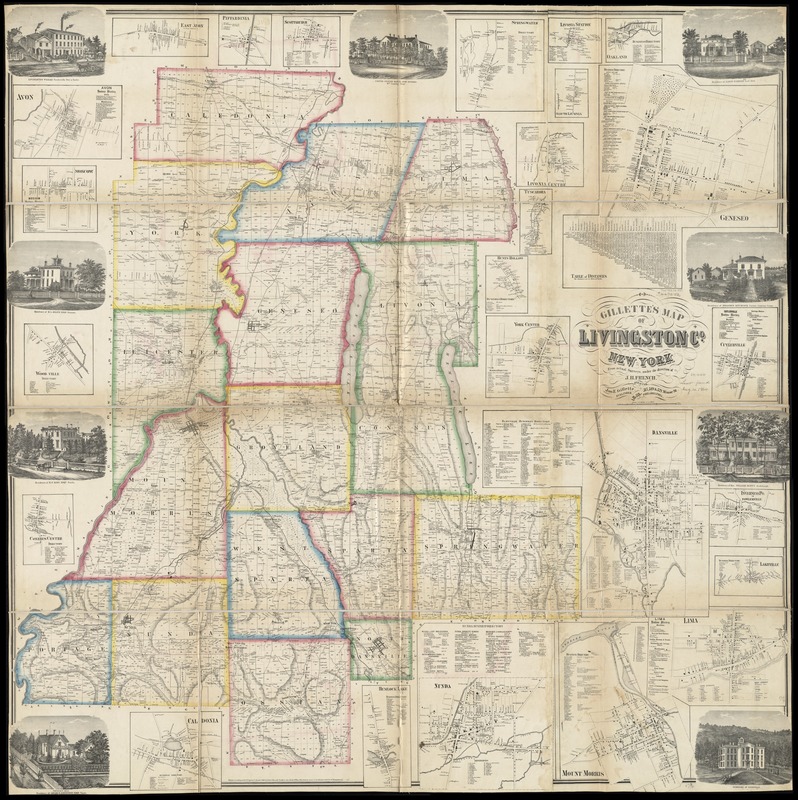
Gillette's map of Livingston Co., New York : from actual surveys
Item Information
- Title:
- Gillette's map of Livingston Co., New York : from actual surveys
- Creator:
- French, J. H. (John Homer), 1824-1888
- Name on Item:
-
under the direction of J.H. French.
- Date:
-
1858
- Format:
-
Maps/Atlases
- Location:
-
Boston Public Library
Norman B. Leventhal Map Center - Collection (local):
-
Norman B. Leventhal Map Center Collection
- Subjects:
-
Landowners--New York (State)--Livingston County--Maps
Real property--New York (State)--Livingston County--Maps
Livingston County (N.Y.)--Maps
- Places:
-
Livingston (county)
- Extent:
- 1 map : col. ; 148 x 148 cm.
- Terms of Use:
-
No known copyright restrictions.
No known restrictions on use.
- Publisher:
-
Philadelphia :
Jno. E. Gillette
- Scale:
-
Scale [1:42,240]
- Language:
-
English
- Notes:
-
Relief shown by hachures.
Shows landowners.
"Entered according to Act of Congress in the year 1858 by Robert Pearsall Smith in the clerk's office of the district court of the eastern district of Pennsylvania."
Includes ill., table of distances, business directories for some towns and 25 local maps.
- Identifier:
-
06_01_010655
- Call #:
-
G3803.L5 1858 .F74
- Barcode:
-
39999065675041


